Bog Lake/Pond
Bog lake, Spring Pond
Troy Weldy
- System
- Lacustrine
- Subsystem
- Natural Lakes And Ponds
- State Protection
- Not Listed
Not listed or protected by New York State.
- Federal Protection
- Not Listed
- State Conservation Status Rank
- S3
Vulnerable in New York - Vulnerable to disappearing from New York due to rarity or other factors (but not currently imperiled); typically 21 to 80 populations or locations in New York, few individuals, restricted range, few remaining acres (or miles of stream), and/or recent and widespread declines.
- Global Conservation Status Rank
- G4
Apparently Secure globally - Uncommon in the world but not rare; usually widespread, but may be rare in some parts of its range; possibly some cause for long-term concern due to declines or other factors.
Summary
Did you know?
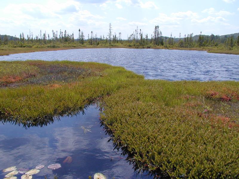
A common feature of bog lakes is the development of a false bottom at a depth of about 0.3 to 0.9 m (1 to 3 ft) below the surface. The false bottom is composed of colloidal material and dissolved humus held in suspension that appears to be a more or less continuous bottom. When disturbed, the suspended material quickly clouds the upper layer of clear water, then slowly settles when the water becomes quiet again.
State Ranking Justification
There are several thousand occurrences statewide. Many occurrences are presumed to have good viability and are protected on public land or private conservation land. This community has statewide distribution, and includes several large, high quality examples especially in the Adirondacks. The current trend of this community is probably stable for occurrences on public land, or declining slightly elsewhere due to moderate threats related to development pressure or alteration to the natural hydrology. This community has declined moderately to substantially from historical numbers likely correlated with past hydrological alterations and excessive clearing/development of the surrounding landscape.
Short-term Trends
The numbers and acreage of bog lakes and ponds in New York have probably remained stable in recent decades as a result of wetland protection regulations. There may be a few cases of slight decline due to alteration of hydrology (e.g., ditching and impoundments) and reduced water quality from nutrient input from surrounding developed uplands.
Long-term Trends
The numbers and acreage of bog lakes and ponds in New York have probably declined moderately from historical numbers likely correlated to alteration of hydrology (e.g., ditching and impoundments) and reduced water quality from nutrient input from surrounding developed uplands. Peatlands may expand over and close smaller bog lakes and ponds over the long term (i.e., centuries) to form a "lake-fill bog" (Daman and French 1987).
Conservation and Management
Conservation Overview
Where practical, maintain or increase the adjacent peatland and upland buffer to reduce storm-water, pollution, and nutrient run-off, while simultaneously capturing sediments before they reach the bog lake/pond. Buffer width should take into account the erodibility of the surrounding soils, slope steepness, and current land use. If possible, minimize the number and size of impervious surfaces in the surrounding landscape. Avoid habitat alteration within the lake and surrounding landscape. For example, roads should not be routed through the lakeshore buffer area. If a lake must be crossed, then bridges and boardwalks are preferred over filling and culverts. Restore lakes that have been affected by unnatural disturbance (e.g., remove obsolete impoundments and ditches in order to restore the natural hydrology). Prevent the spread of invasive exotic species into the lake through appropriate direct management, and by minimizing potential dispersal corridors.
Threats
Bog lakes and ponds are threatened by development in the surrounding landscape and its associated run-off (e.g., agricultural, residential, roads, railroads, golf courses, campgrounds), recreational overuse (e.g., boating, shoreline camping), and habitat alteration in the adjacent landscape (e.g., excessive logging, pollution, nutrient loading). Alteration to the natural hydrology is also a threat to this community (e.g., impoundments, blocked culverts). Bog lakes and ponds are threatened by invasive species, such as Eurasian milfoil (Myriophyllum spicatum).
Conservation Strategies and Management Practices
Where practical, maintain or increase the adjacent peatland and upland buffer to reduce storm-water, pollution, and nutrient run-off, while simultaneously capturing sediments before they reach the bog lake/pond. Buffer width should take into account the erodibility of the surrounding soils, slope steepness, and current land use. If possible, minimize the number and size of impervious surfaces in the surrounding landscape. Avoid habitat alteration within the lake and surrounding landscape. For example, roads should not be routed through the lakeshore buffer area. If a lake must be crossed, then bridges and boardwalks are preferred over filling and culverts. Restore lakes that have been affected by unnatural disturbance (e.g., remove obsolete impoundments and ditches in order to restore the natural hydrology). Prevent the spread of invasive exotic species into the lake through appropriate direct management, and by minimizing potential dispersal corridors.
Development and Mitigation Considerations
When considering road construction and other development activities minimize actions that will change what water carries and how water travels to this community, both on the surface and underground. Water traveling over-the-ground as run-off usually carries an abundance of silt, clay, and other particulates during (and often after) a construction project. While still suspended in the water, these particulates make it difficult for aquatic animals to find food; after settling to the bottom of the wetland, these particulates bury small plants and animals and alter the natural functions of the community in many other ways. Thus, road construction and development activities near this community type should strive to minimize particulate-laden run-off into this community. Water traveling on the ground or seeping through the ground also carries dissolved minerals and chemicals. Road salt, for example, is becoming an increasing problem both to natural communities and as a contaminant in household wells. Fertilizers, detergents, and other chemicals that increase the nutrient levels in wetlands cause algae blooms and eventually an oxygen-depleted environment where few animals can live. Herbicides and pesticides often travel far from where they are applied and have lasting effects on the quality of the natural community. So, road construction and other development activities should strive to consider: 1. how water moves through the ground, 2. the types of dissolved substances these development activities may release, and 3. how to minimize the potential for these dissolved substances to reach this natural community.
Inventory Needs
Survey for occurrences statewide to advance documentation and classification of bog lakes and ponds. A statewide review of bog lakes and ponds is desirable. Continue searching for bog lakes and ponds in good condition (A- to AB-ranked). Review and incorporate data on occurrences in NY gathered by the Adirondack Lakes Survey Corporation, the Adirondack Park Invasive Plant Program, and the New York State Federation of Lake Associations, Inc.
Research Needs
Research is needed to fill information gaps about bog lakes and ponds, especially to advance our understanding of their classification, hydrology, floristic variation, and characteristic fauna. In addition, there is a need to collect sufficient quantitative data to support the recognition of a higher pH variant tentatively called "circumneutral bog lake" and change the current name to "acidic bog lake." More data are needed to consider spitting this community into "bog lake" and "bog pond" types, perhaps by using a size threshold. Lastly, the distinction between meromictic lake and bog lake needs to be more critically evaluated, because occasionally bog lakes can also become meromictic or chemically stratified.
Rare Species
Range
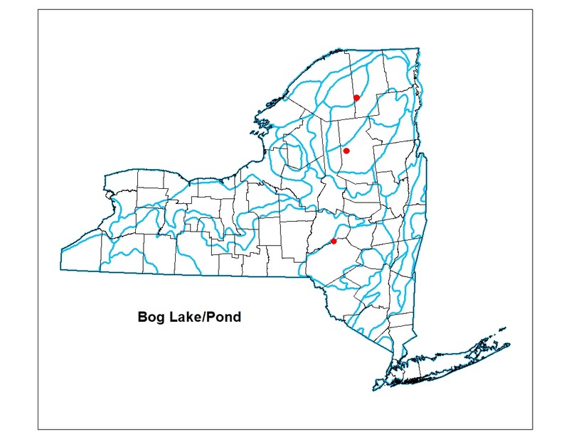
New York State Distribution
Bog lakes and ponds are sparsely scattered but widespread throughout New York State north of the Coastal Lowlands ecozone; especially common in the Adirondacks. They are limited to areas in the state where sufficient peat has accumulated within a basin or kettlehole leaving an open water "eye" within the peatland.
Global Distribution
This broadly-defined community may be worldwide. Examples with the greatest biotic affinities to New York occurrences are suspected to span north to southern Canada, west to Minnesota, southwest to Indiana and Tennessee, and southeast to South Carolina.
Best Places to See
- Helldiver Pond, Moose River Plains Wild Forest (Hamilton County)
- Spring Pond Bog Preserve (Franklin County)
- Pink Pond Santa Clara (Franklin County)
- Rolley Pond Santa Clara (Franklin County)
- Squash Pond Webb (Herkimer County)
- Ferd's Bog Long Lake (Hamilton County)
- Northwest of Little Ampersand Pond (Franklin County)
- Rat Pond Santa Clara (Franklin County)
- Blue Pond Altamont (Franklin County)
- Little Echo Pond Santa Clara (Franklin County)
- Wheeler Pond Santa Clara (Franklin County)
- Long Pond Indian Lake (Hamilton County)
- Rock Pond Waverly (Franklin County)
- Bog Pond Harrietstown (Franklin County)
- Mud Pond Black Brook (Clinton County)
- North of Plumley Pond Long Lake (Hamilton County)
- Roakdale Bog (Franklin County)
- Simkins Pond (Franklin County)
- St. Regis Wild Area Bog Harrrietstown (Franklin County)
Identification Comments
General Description
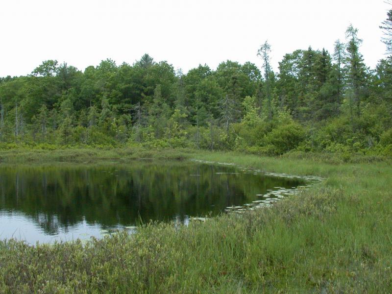
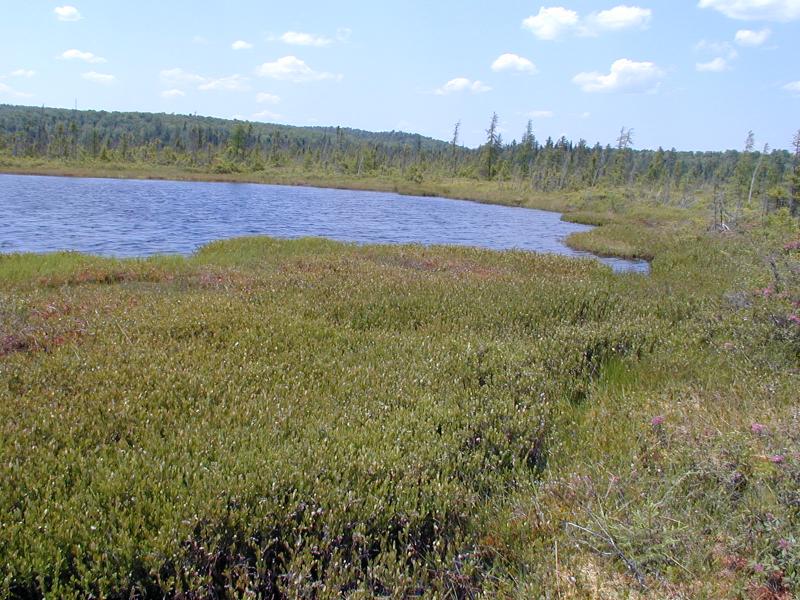
The aquatic community of a dystrophic lake (an acidic lake with brownish water that contains a high amount of organic matter) that typically occurs in a small, shallow basin (e.g., a kettehole) that is protected from wind and is poorly drained. These lakes occur in areas with non-calcareous bedrock or glacial till; many are fringed or surrounded by a floating mat of vegetation (in New York usually either bog or poor fen). Characteristic features of a dystrophic lake include the following: murky water that is stained brown, with low transparency; water that is low in plant nutrients (especially low in calcium), with naturally low pH (less than 5.4); and the lake may have oxygen deficiencies in deeper water (the profundal zone). The lack of calcium blocks bacterial action, reducing the rate of decay of organic matter with subsequent accumulation of peat or muck sediments. Colloidal and dissolved humus material reduces transparency and increases acidity of the water. Species diversity in bog lakes is low in all types of aquatic organisms (phytoplankton, macrophytes, zooplankton, zoobenthos, and fish); many bog lakes have no fish at all. The abundance of each species present is also low in all types of organisms, except for aquatic macrophytes and peat mosses (Sphagnum spp.) along the edge of the bog mat. A common feature of bog lakes is the development of a false bottom at a depth of about 0.3 to 0.9 m (1 to 3 ft) below the surface. The false bottom is composed of colloidal material and dissolved humus held in suspension that appears to be a more or less continuous bottom. When disturbed, the suspended material quickly clouds the upper layer of clear water, then slowly settles when the water becomes quiet again. Occasionally bog lakes become meromictic or chemically stratified; the chemical gradient supercedes the usual stratification by temperature.
Characters Most Useful for Identification
Characteristic macrophytes include water-shield (Brasenia schreberi), fragrant white water lily (Nymphaea odorata), yellow pond-lily (Nuphar microphylla, and Nuphar variegata), bladderworts (Utricularia vulgaris, U. geminiscapa, U. purpurea), pondweeds (Potamogeton epihydrus, P. oakesianus), bur-reeds (Sparganium fluctuans, S. angustifolium), and clubrush (Scirpus subterminalis). Characteristic zooplankton may include the rotifers Keratella spp. and Brachionus spp. A characteristic fish is brown bullhead (Ameiurus nebulosus). Characteristic invertebrates include larvae of midges (Chironomus spp.) and phantom midges (Chaoborus spp.) in the benthos. Other characteristic invertebrates may include the amphipod Hyallela azteca, the mollusks Musculium spp. and Ferresia californica, and the midges Tribelos spp., Phaenopsectra spp., and Zalutschia spp.
Elevation Range
Known examples of this community have been found at elevations between 1,534 feet and 1,780 feet.
Best Time to See
Bog lakes and ponds are fun to explore in mid- to late summer by canoe when fragrant white water lily and spatter dock are in bloom. Frozen bog lakes can be easier to access on foot in the winter.
Bog Lake/Pond Images
Troy Weldy
Andrew Nelson, SUNY-Oswego
Gregory J. Edinger
Troy Weldy
Classification
International Vegetation Classification Associations
This New York natural community encompasses all or part of the concept of the following International Vegetation Classification (IVC) natural community associations. These are often described at finer resolution than New York's natural communities. The IVC is developed and maintained by NatureServe.
- American White Water-lily - (Yellow Pond-lily, Variegated Yellow Pond-lily) Aquatic Vegetation (CEGL002562)
NatureServe Ecological Systems
This New York natural community falls into the following ecological system(s). Ecological systems are often described at a coarser resolution than New York's natural communities and tend to represent clusters of associations found in similar environments. The ecological systems project is developed and maintained by NatureServe.
- Laurentian-Acadian Freshwater Marsh (CES201.594)
Characteristic Species
-
Emergent aquatics
- Dulichium arundinaceum var. arundinaceum (three-way sedge)
- Juncus spp.
- Sparganium fluctuans (floating bur-reed)
-
Floating-leaved aquatics
- Brasenia schreberi (water-shield)
- Nuphar microphylla (small-leaved yellow pond-lily, small-leaved spatter-dock)
- Nuphar variegata (common yellow pond-lily, common spatter-dock)
- Nymphaea odorata ssp. odorata (fragrant white water-lily)
- Potamogeton epihydrus (ribbon-leaved pondweed)
- Potamogeton oakesianus (Oakes's pondweed)
- Sparganium angustifolium (narrow-leaved bur-reed)
-
Submerged aquatics
- Schoenoplectus subterminalis (water bulrush)
- Utricularia cornuta (horned bladderwort)
- Utricularia geminiscapa (hidden-fruited bladderwort)
- Utricularia vulgaris ssp. macrorhiza (greater bladderwort)
-
Unvegetated
- amphipods (Hyallela azteca)
- midges (Chironomus spp.)
- midges (Tribelos spp., Phaenopsectra spp., Zalutschia spp.)
- mollusks (Ferresia californica)
- mollusks (Musculium spp.)
- phantom midges (Chaoborus spp.)
- zooplankton - rotifers (Brachionus spp.)
- zooplankton - rotifers (Keratella spp.).
Similar Ecological Communities
- Eutrophic dimictic lake
(guide)
Eutrophic dimictic lake: The aquatic community of a nutrient-rich lake that occurs in a broad, shallow basin. These lakes are dimictic: they have two periods of mixing or turnover (spring and fall); they are thermally stratified in the summer, and they freeze over and become inversely stratified in the winter. Aquatic macrophytes are abundant in shallow water, and there are many species present, but species diversity is generally lower than in mesotrophic lakes. Characteristic plants include tapegrass (Vallisneria americana), pondweeds (Potamogeton spp.), bur-reeds (Sparganium spp.), and the floating aquatic plants white water-lily (Nymphaea spp.), yellow pond-lily (Nuphar luteum), and water-shield (Brasenia schreberi). Characteristic features of a eutrophic lake include the following: yellow, green, or brownish-green water that is murky, with low transparency (Secchi disk depths typically less than 2.5 m, but up to 4 m in some cases); water rich in plant nutrients (especially high in phosphorus, nitrogen and calcium); high primary productivity (inorganic carbon fixed = 75 to 250 g/m2/yr); lake sediments that are rich in organic matter (usually consisting of a fine organic silt or copropel); water that is well-oxygenated above the summer thermocline, but oxygen-depleted below the summer thermocline or under ice; epilimnion volume that is relatively large compared with hypolimnion; and a weedy shoreline. Alkalinity is typically high (greater than 12.5 mg/l calcium carbonate). Bog lake/pond: The aquatic community of a dystrophic lake (an acidic lake with brownish water that contains a high amount of organic matter) that typically occurs in a small, shallow basin (e.g., a kettehole) that is protected from wind and is poorly drained. These lakes occur in areas with non-calcareous bedrock or glacial till; many are fringed or surrounded by a floating mat of vegetation (in New York usually either bog or poor fen). Characteristic features of a dystrophic lake include the following: murky water that is stained brown, with low transparency; water that is low in plant nutrients (especially low in calcium), with naturally low pH (less than 5.4); and the lake may have oxygen deficiencies in deeper water (the profundal zone). The lack of calcium blocks bacterial action, reducing the rate of decay of organic matter with subsequent accumulation of peat or muck sediments. Colloidal and dissolved humus material reduces transparency and increases acidity of the water. Characteristic macrophytes include water-shield (Brasenia schreberi), fragrant white water lily (Nymphaea odorata), yellow pond-lily (Nuphar microphylla, and Nuphar variegata), bladderworts (Utricularia vulgaris, U. geminiscapa, U. purpurea), pondweeds (Potamogeton epihydrus, P. oakesianus), bur-reeds (Sparganium fluctuans, S. angustifolium), and clubrush (Scirpus subterminalis). Characteristic zooplankton may include the rotifers Keratella spp. and Brachionus spp.
- Eutrophic pond
(guide)
Eutrophic pond: The aquatic community of a small, shallow, nutrient-rich pond. Species diversity is typically high. Aquatic vegetation is abundant. Characteristic plants include coontail (Ceratophyllum demersum), duckweeds (Lemna minor, L. trisulca), waterweed (Elodea canadensis), pondweeds (Potamogeton spp.), water starwort (Heteranthera dubia), bladderworts (Utricularia spp.), naiad (Najas flexilis), tapegrass or wild celery (Vallisneria americana), algae (Cladophora spp.), common yellow pond-lily (Nuphar variegata), and white water-lily (Nymphaea odorata). The water is usually green with algae, and the bottom is mucky. Eutrophic ponds are too shallow to remain thermally stratified throughout the summer; they often freeze and become inversely stratified in the winter (coldest water at the surface), therefore they are winter-stratified monomictic ponds. Additional characteristic features of a eutrophic pond include the following: water that is murky, with low transparency (Secchi disk depths typically less than 4 m); water rich in plant nutrients (especially high in phosphorus, nitrogen, and calcium), high primary productivity (inorganic carbon fixed = 75 to 250 g/m2/yr) and a weedy shoreline. Alkalinity is typically high (greater than 12.5 mg/l calcium carbonate). Bog lake/pond: The aquatic community of a dystrophic lake (an acidic lake with brownish water that contains a high amount of organic matter) that typically occurs in a small, shallow basin (e.g., a kettehole) that is protected from wind and is poorly drained. These lakes occur in areas with non-calcareous bedrock or glacial till; many are fringed or surrounded by a floating mat of vegetation (in New York usually either bog or poor fen). Characteristic features of a dystrophic lake include the following: murky water that is stained brown, with low transparency; water that is low in plant nutrients (especially low in calcium), with naturally low pH (less than 5.4); and the lake may have oxygen deficiencies in deeper water (the profundal zone). The lack of calcium blocks bacterial action, reducing the rate of decay of organic matter with subsequent accumulation of peat or muck sediments. Colloidal and dissolved humus material reduces transparency and increases acidity of the water. Characteristic macrophytes include water-shield (Brasenia schreberi), fragrant white water lily (Nymphaea odorata), yellow pond-lily (Nuphar microphylla, and Nuphar variegata), bladderworts (Utricularia vulgaris, U. geminiscapa, U. purpurea), pondweeds (Potamogeton epihydrus, P. oakesianus), bur-reeds (Sparganium fluctuans, S. angustifolium), and clubrush (Scirpus subterminalis). Characteristic zooplankton may include the rotifers Keratella spp. and Brachionus spp.
- Meromictic lake
(guide)
Meromictic lake: the aquatic community of a relatively deep lake with small surface area that is so protected from wind-stirring that it has no annual periods of complete mixing, and remains chemically stratified throughout the year. These lakes may be protected from mixing by a sheltered surrounding landscape (e.g., a deep basin) or by adjacent tree cover. Meromictic lakes in New York freeze over and become inversely stratified in the winter (coldest water at the surface); they pass through spring, and fall periods of isothermy without circulating. Meromictic lakes frequently have dichothermic stratification, meaning that the minimum temperature occurs in the middle stratum. The stagnant waters in the lower part of a meromictic lake become heavily loaded with dissolved salts, and lack oxygen. Chemical stratification is most often measured by salinity gradients, or total cation and anion concentrations. Gradients may be present for chemicals, such as hydrogen sulfide, ammonia, phosphorus, or iron. Flushing rates are typically low. Some examples of this lake type may be dystrophic, and thus resemble bog lakes. Species diversity is low because very few organisms can tolerate the extreme chemical conditions of the lower strata of a meromictic lake. Fishes are absent or sparse. Bog lake/pond: The aquatic community of a dystrophic lake (an acidic lake with brownish water that contains a high amount of organic matter) that typically occurs in a small, shallow basin (e.g., a kettehole) that is protected from wind and is poorly drained. These lakes occur in areas with non-calcareous bedrock or glacial till; many are fringed or surrounded by a floating mat of vegetation (in New York usually either bog or poor fen). Characteristic features of a dystrophic lake include the following: murky water that is stained brown, with low transparency; water that is low in plant nutrients (especially low in calcium), with naturally low pH (less than 5.4); and the lake may have oxygen deficiencies in deeper water (the profundal zone). The lack of calcium blocks bacterial action, reducing the rate of decay of organic matter with subsequent accumulation of peat or muck sediments. Colloidal and dissolved humus material reduces transparency and increases acidity of the water. Characteristic macrophytes include water-shield (Brasenia schreberi), fragrant white water lily (Nymphaea odorata), yellow pond-lily (Nuphar microphylla, and Nuphar variegata), bladderworts (Utricularia vulgaris, U. geminiscapa, U. purpurea), pondweeds (Potamogeton epihydrus, P. oakesianus), bur-reeds (Sparganium fluctuans, S. angustifolium), and clubrush (Scirpus subterminalis). Characteristic zooplankton may include the rotifers Keratella spp. and Brachionus spp.
- Mesotrophic dimictic lake
(guide)
Mesotrophic dimictic lake: The aquatic community of a lake that is intermediate between an oligotrophic lake and a eutrophic lake. These lakes are dimictic: they have two periods of mixing or turnover (spring and fall), they are thermally stratified in the summer (warmest water at the surface), and they freeze over and become inversely stratified in the winter (coldest water at the surface). These lakes typically have a diverse mixture of submerged macrophytes, such as several species of pondweeds (Potamogeton amplifolius, P. praelongus, P. robbinsii), water celery or tape grass (Vallisneria americana), and bladderworts (Utricularia spp.). Characteristic features of a mesotrophic lake include the following: water with medium transparency (Secchi disk depths of 2 to 4 m); water with moderate amounts of plant nutrients; moderate primary productivity (inorganic carbon fixed = 25 to 75 g/m2/yr); lake sediments with moderate amounts of organic matter; and moderately well-oxygenated water. Alkalinity is typically moderate (slightly greater than 12.5 mg/l calcium carbonate). Bog lake/pond: The aquatic community of a dystrophic lake (an acidic lake with brownish water that contains a high amount of organic matter) that typically occurs in a small, shallow basin (e.g., a kettehole) that is protected from wind and is poorly drained. These lakes occur in areas with non-calcareous bedrock or glacial till; many are fringed or surrounded by a floating mat of vegetation (in New York usually either bog or poor fen). Characteristic features of a dystrophic lake include the following: murky water that is stained brown, with low transparency; water that is low in plant nutrients (especially low in calcium), with naturally low pH (less than 5.4); and the lake may have oxygen deficiencies in deeper water (the profundal zone). The lack of calcium blocks bacterial action, reducing the rate of decay of organic matter with subsequent accumulation of peat or muck sediments. Colloidal and dissolved humus material reduces transparency and increases acidity of the water. Characteristic macrophytes include water-shield (Brasenia schreberi), fragrant white water lily (Nymphaea odorata), yellow pond-lily (Nuphar microphylla, and Nuphar variegata), bladderworts (Utricularia vulgaris, U. geminiscapa, U. purpurea), pondweeds (Potamogeton epihydrus, P. oakesianus), bur-reeds (Sparganium fluctuans, S. angustifolium), and clubrush (Scirpus subterminalis). Characteristic zooplankton may include the rotifers Keratella spp. and Brachionus spp.
- Oligotrophic dimictic lake
(guide)
Oligotrophic dimictic lake: The aquatic community of a nutrient-poor lake that often occurs in deep, steeply-banked basins. These lakes are dimictic, meaning they have two periods of mixing and turnover (spring and fall); they are stratified in the summer, then they freeze in winter and become inversely stratified. Common physical characteristics of oligotrophic lakes include blue or green highly transparent water (Secchi disk depths from 4 to 8 m), low dissolved nutrients (especially nitrogen and calcium), low primary productivity, and sediment with low levels of organic matter. Additionally, the lakes have an epilimnion volume that is low relative to the hypolimnion, high dissolved oxygen levels year-round through all strata, and low alkalinity. The plant community is primarily in the shallow parts of the lake, between 1 and 3 m (3 to 10 feet), and is dominated by rosette-leaved aquatic species. Characteristic species include seven-angle pipewort (Eriocaulon aquaticum), water lobelia (Lobelia dortmanna), quillworts (Isoetes echinospora ssp. muricata, I. lacustris), milfoils (Myriophyllum alterniflorum, M. tenellum), bladderworts (Utricularia purpuea, U. resupinata), tape grass (Vallisneria americana), and creeping buttercup (Ranunculus repens). Bog lake/pond: The aquatic community of a dystrophic lake (an acidic lake with brownish water that contains a high amount of organic matter) that typically occurs in a small, shallow basin (e.g., a kettehole) that is protected from wind and is poorly drained. These lakes occur in areas with non-calcareous bedrock or glacial till; many are fringed or surrounded by a floating mat of vegetation (in New York usually either bog or poor fen). Characteristic features of a dystrophic lake include the following: murky water that is stained brown, with low transparency; water that is low in plant nutrients (especially low in calcium), with naturally low pH (less than 5.4); and the lake may have oxygen deficiencies in deeper water (the profundal zone). The lack of calcium blocks bacterial action, reducing the rate of decay of organic matter with subsequent accumulation of peat or muck sediments. Colloidal and dissolved humus material reduces transparency and increases acidity of the water. Characteristic macrophytes include water-shield (Brasenia schreberi), fragrant white water lily (Nymphaea odorata), yellow pond-lily (Nuphar microphylla, and Nuphar variegata), bladderworts (Utricularia vulgaris, U. geminiscapa, U. purpurea), pondweeds (Potamogeton epihydrus, P. oakesianus), bur-reeds (Sparganium fluctuans, S. angustifolium), and clubrush (Scirpus subterminalis). Characteristic zooplankton may include the rotifers Keratella spp. and Brachionus spp.
- Oligotrophic pond
(guide)
Oligotrophic pond: The aquatic community of a small, shallow, nutrient-poor pond. The water is very clear, and the bottom is usually sandy or rocky. Aquatic vegetation is typically sparse, and species diversity is low. Characteristic species are rosette-leaved aquatics such as pipewort (Eriocaulon aquaticum), water lobelia (Lobelia dortmanna), and quillwort (Isoetes echinospora). Oligotrophic ponds are too shallow to remain thermally stratified throughout the summer; they often freeze and become inversely stratified in the winter (coldest water at the surface), therefore they are winter-stratified monomictic ponds. Additional characteristic features of an oligotrophic pond include the following: blue or green water with high transparency (Secchi disk depths of 4 to 8 m); water low in plant nutrients (especially low in nitrogen, also low in calcium); low primary productivity (inorganic carbon fixed = 7 to 25 g/m2/yr). Alkalinity is typically low (less than 12.5 mg/l calcium carbonate). Bog lake/pond: The aquatic community of a dystrophic lake (an acidic lake with brownish water that contains a high amount of organic matter) that typically occurs in a small, shallow basin (e.g., a kettehole) that is protected from wind and is poorly drained. These lakes occur in areas with non-calcareous bedrock or glacial till; many are fringed or surrounded by a floating mat of vegetation (in New York usually either bog or poor fen). Characteristic features of a dystrophic lake include the following: murky water that is stained brown, with low transparency; water that is low in plant nutrients (especially low in calcium), with naturally low pH (less than 5.4); and the lake may have oxygen deficiencies in deeper water (the profundal zone). The lack of calcium blocks bacterial action, reducing the rate of decay of organic matter with subsequent accumulation of peat or muck sediments. Colloidal and dissolved humus material reduces transparency and increases acidity of the water. Characteristic macrophytes include water-shield (Brasenia schreberi), fragrant white water lily (Nymphaea odorata), yellow pond-lily (Nuphar microphylla, and Nuphar variegata), bladderworts (Utricularia vulgaris, U. geminiscapa, U. purpurea), pondweeds (Potamogeton epihydrus, P. oakesianus), bur-reeds (Sparganium fluctuans, S. angustifolium), and clubrush (Scirpus subterminalis). Characteristic zooplankton may include the rotifers Keratella spp. and Brachionus spp.
- Summer-stratified monomictic lake
(guide)
Summer-stratified monomictic lakes are so deep (or large) that they have only one period of mixing or turnover each year (monomictic), and one period of stratification. These lakes generally do not freeze over in winter (except in unusually cold years), or form only a thin or sporadic ice cover during the coldest parts of midwinter, so the water circulates and is isothermal during the winter (similar temperature though the water column). These lakes are typically thermally stratified only in the summer (warmest water at the surface); they are oligotrophic to mesotrophic and alkaline. Characteristic aquatic macrophytes include pondweeds (Potamogeton gramineus, P. richardsonii, P. pectinatus), horned pondweed (Zannichellia palustris), naiad (Najas flexilis), waterweed (Elodea canadensis), tapegrass or wild celery (Vallisneria americana), and coontail (Ceratophyllum demersum). Bog lake/pond: The aquatic community of a dystrophic lake (an acidic lake with brownish water that contains a high amount of organic matter) that typically occurs in a small, shallow basin (e.g., a kettehole) that is protected from wind and is poorly drained. These lakes occur in areas with non-calcareous bedrock or glacial till; many are fringed or surrounded by a floating mat of vegetation (in New York usually either bog or poor fen). Characteristic features of a dystrophic lake include the following: murky water that is stained brown, with low transparency; water that is low in plant nutrients (especially low in calcium), with naturally low pH (less than 5.4); and the lake may have oxygen deficiencies in deeper water (the profundal zone). The lack of calcium blocks bacterial action, reducing the rate of decay of organic matter with subsequent accumulation of peat or muck sediments. Colloidal and dissolved humus material reduces transparency and increases acidity of the water. Characteristic macrophytes include water-shield (Brasenia schreberi), fragrant white water lily (Nymphaea odorata), yellow pond-lily (Nuphar microphylla, and Nuphar variegata), bladderworts (Utricularia vulgaris, U. geminiscapa, U. purpurea), pondweeds (Potamogeton epihydrus, P. oakesianus), bur-reeds (Sparganium fluctuans, S. angustifolium), and clubrush (Scirpus subterminalis). Characteristic zooplankton may include the rotifers Keratella spp. and Brachionus spp.
- Winter-stratified monomictic lake
(guide)
Winter-stratified monomictic lakes have only one period of mixing each year because they are very shallow in relation to its size and is completely exposed to winds. These lakes continue to circulate throughout the summer and typically never become thermally stratified in that season. They are only stratified in the winter when they freeze over and become inversely stratified (coldest water at the surface). They are eutrophic to mesotrophic. Littoral, and epilimnion species assemblages predominate. Pelagic species assemblages are well developed. Vascular plants are typically diverse. Characteristic aquatic macrophytes include water stargrass (Heteranthera dubia), coontail (Ceratophyllum demersum), waterweed (Elodea spp.), naiad (Najas flexilis), tapegrass (Vallisneria americana), and pondweeds (Potamogeton perfoliatus, P. pectinatus, P. pusillus, P. richardsonii, P. nodosus, P. zosteriformis). The macroalgae Chara may be abundant. Bog lake/pond: The aquatic community of a dystrophic lake (an acidic lake with brownish water that contains a high amount of organic matter) that typically occurs in a small, shallow basin (e.g., a kettehole) that is protected from wind and is poorly drained. These lakes occur in areas with non-calcareous bedrock or glacial till; many are fringed or surrounded by a floating mat of vegetation (in New York usually either bog or poor fen). Characteristic features of a dystrophic lake include the following: murky water that is stained brown, with low transparency; water that is low in plant nutrients (especially low in calcium), with naturally low pH (less than 5.4); and the lake may have oxygen deficiencies in deeper water (the profundal zone). The lack of calcium blocks bacterial action, reducing the rate of decay of organic matter with subsequent accumulation of peat or muck sediments. Colloidal and dissolved humus material reduces transparency and increases acidity of the water. Characteristic macrophytes include water-shield (Brasenia schreberi), fragrant white water lily (Nymphaea odorata), yellow pond-lily (Nuphar microphylla, and Nuphar variegata), bladderworts (Utricularia vulgaris, U. geminiscapa, U. purpurea), pondweeds (Potamogeton epihydrus, P. oakesianus), bur-reeds (Sparganium fluctuans, S. angustifolium), and clubrush (Scirpus subterminalis). Characteristic zooplankton may include the rotifers Keratella spp. and Brachionus spp.
Vegetation
Percent cover
This figure helps visualize the structure and "look" or "feel" of a typical Bog Lake/Pond. Each bar represents the amount of "coverage" for all the species growing at that height. Because layers overlap (shrubs may grow under trees, for example), the shaded regions can add up to more than 100%.
Additional Resources
References
Clausen, R.T. 1940. Aquatic vegetation of the Lake Ontario watershed. In: A biological survey of the Lake Ontario watershed, including all waters from Little Sandy Creek westward except the Genesee and Oswego River systems; supplemental to 29th annual report, Biological survey report XVI. pp 167-23.1
Cole, G.A. 1979. Textbook of limnology. The C.V. Mosby Co., Saint Louis, MO.
Edinger, G. J., D. J. Evans, S. Gebauer, T. G. Howard, D. M. Hunt, and A. M. Olivero (editors). 2014. Ecological Communities of New York State. Second Edition. A revised and expanded edition of Carol Reschke’s Ecological Communities of New York State. New York Natural Heritage Program, New York State Department of Environmental Conservation, Albany, NY. https://www.nynhp.org/ecological-communities/
Edinger, Gregory J., D.J. Evans, Shane Gebauer, Timothy G. Howard, David M. Hunt, and Adele M. Olivero (editors). 2002. Ecological Communities of New York State. Second Edition. A revised and expanded edition of Carol Reschke's Ecological Communities of New York State. (Draft for review). New York Natural Heritage Program, New York State Department of Environmental Conservation. Albany, NY. 136 pp.
Maitland, P.S. 1978. Biology of fresh waters. John Wiley, and Sons, New York.
New York Natural Heritage Program. 2024. New York Natural Heritage Program Databases. Albany, NY.
Nichols, W. F. 2015. Natural Freshwater Lakes and Ponds in New Hampshire: Draft Classification. NH Natural Heritage Bureau, Concord, NH.
Olivero-Sheldon, A. and M.G. Anderson. 2016. Northeast Lake and Pond Classification. The Nature Conservancy, Eastern Conservation Science, Eastern Regional Office. Boston, MA.
Reschke, Carol. 1990. Ecological communities of New York State. New York Natural Heritage Program, New York State Department of Environmental Conservation. Latham, NY. 96 pp. plus xi.
Links
- Adirondack Lakes Survey Corporation
- Adirondack Park Invasive Plant Program (APIPP) Aquatic Program Early Detection Reports
- Lakes and Rivers
- New York State Federation of Lake Associations (NYSFOLA) Aquatic Invasive Species by County
- Northeast Lake and Pond Classification System (TNC)
- Spring Pond Bog Preserve (TNC)
About This Guide
This guide was authored by: Gregory J. Edinger
Information for this guide was last updated on: December 14, 2023
Please cite this page as:
New York Natural Heritage Program. 2024.
Online Conservation Guide for
Bog lake/pond.
Available from: https://guides.nynhp.org/bog-lakepond/.
Accessed July 26, 2024.