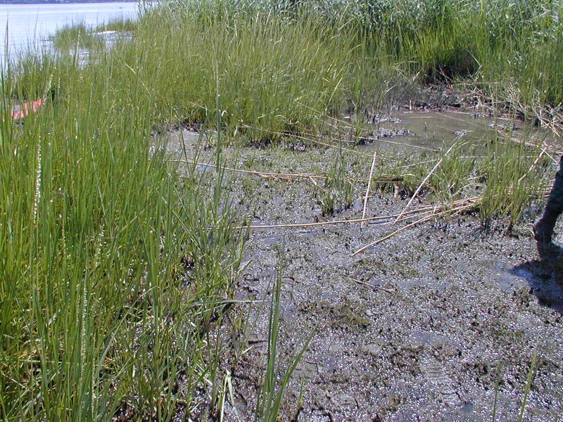
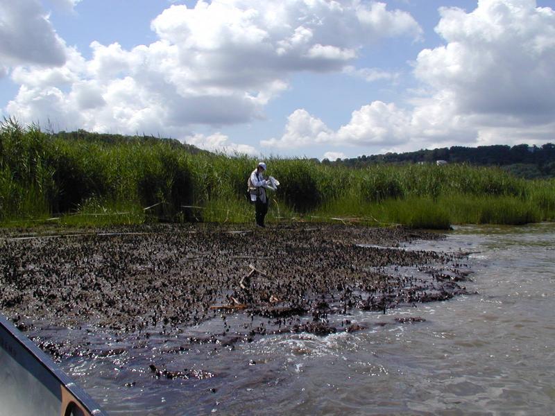
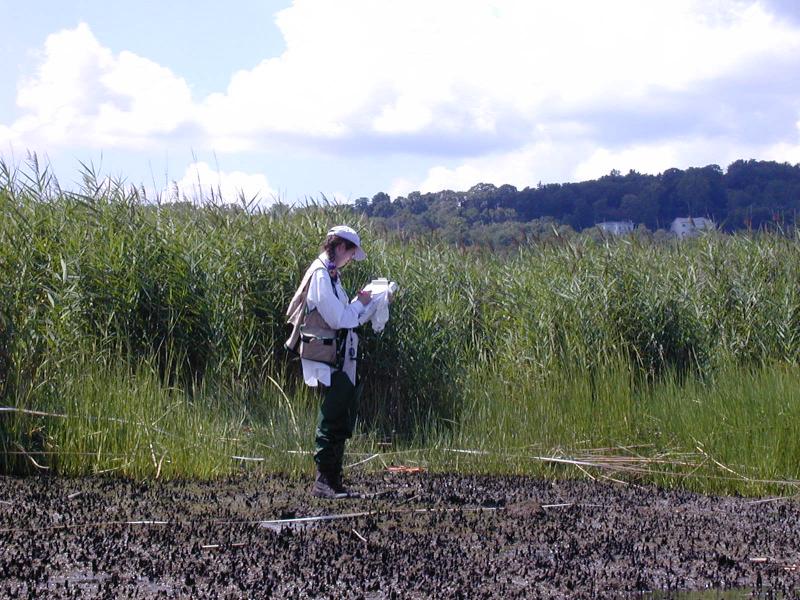
Brackish Intertidal Mudflats
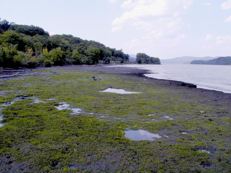
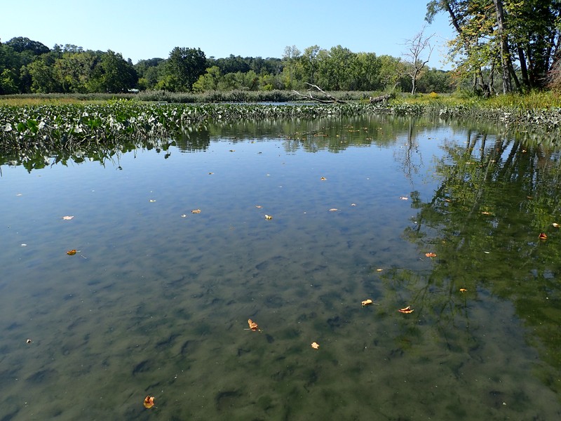
Brackish intertidal mudflats at Con Hook.
Troy Weldy
- System
- Estuarine
- Subsystem
- Estuarine Intertidal
- State Protection
- Not Listed
Not listed or protected by New York State.
- Federal Protection
- Not Listed
- State Conservation Status Rank
- S1
Critically Imperiled in New York - Especially vulnerable to disappearing from New York due to extreme rarity or other factors; typically 5 or fewer populations or locations in New York, very few individuals, very restricted range, very few remaining acres (or miles of stream), and/or very steep declines.
- Global Conservation Status Rank
- G3G4
Vulnerable globally, or Apparently Secure - At moderate risk of extinction, with relatively few populations or locations in the world, few individuals, and/or restricted range; or uncommon but not rare globally; may be rare in some parts of its range; possibly some cause for long-term concern due to declines or other factors. More information is needed to assign either G3 or G4.
Summary
Did you know?
Mudflats contain mobile invertebrates such as clams, snails, worms, and crustaceans that are adapted to the unstable surface of the mudflat, which is subjected to daily erosion and redeposition by tidal currents. These populations turnover at a high rate due to salinity changes. Fish such as alewife, American shad, white perch, rainbow smelt, striped bass, and smallmouth bass feed on these invertebrates in the submerged brackish intertidal mudflats during high tide. Muskrat, mink, egrets, herons, snapping turtles, and blue claw crab are also found in this community.
State Ranking Justification
There are about twenty occurrences statewide. A few documented occurrences have good viability and a few are protected on public land or private conservation land. This community is restricted to brackish portions of estuaries in the state and includes a few moderate size, good quality examples. The current trend of this community is probably stable for occurrences on public land, or declining slightly elsewhere due to moderate threats that include alteration of the natural hydrology and invasive species.
Short-term Trends
The number of brackish intertidal mudflats in New York have probably remained stable in recent decades as a result of wetland protection regulations.
Long-term Trends
The number of brackish intertidal mudflats in New York have probably declined substantially from historical numbers likely correlated with shoreline development and river channel dredging.
Conservation and Management
Threats
The main threats to this community are shoreline development (including railroad tracks), and invasion of exotic species, such as water chestnut (Trapa natans). Recreational boat traffic that scrapes across the mudflats at high tides causes direct degradation. Dredging of shipping lanes may also pose a threat by reducing water quality and altering the natural tidal regime and sediment deposition.
Conservation Strategies and Management Practices
Maintain tidal regime in marshes that have been cut off from the Hudson River near the railroad tracks.
Development and Mitigation Considerations
Strive to minimize or eliminate hardened shorelines and maintain very low-sloped shorelines within the tidal zone. Maintain functional connectivity between the river and the mudflat to enable full tidal flushing during each tidal cycle. For example, barriers such as railway causeways should have numerous culverts to allow sufficient hydrologic connectivity.
Inventory Needs
Survey areas adjacent to known brackish tidal marshes and brackish subtidal aquatic beds for more examples of intertidal mudflats. Search for sites on Long Island where occurrences may be too small to be recognized as this community.
Research Needs
Collect sufficient plot data to describe variants based on topographic setting (e.g., large flats in open river, enclosed basins, adjacent to islands, along freshwater tidal creeks, etc.).
Rare Species
- Bidens laevis (Smooth Beggar Ticks) (guide)
- Bolboschoenus maritimus ssp. paludosus (American Saltmarsh Bulrush) (guide)
- Cardamine longii (Long's Bittercress) (guide)
- Diplachne fusca ssp. fascicularis (Salt-meadow Grass) (guide)
- Elatine americana (American Waterwort) (guide)
- Eriocaulon parkeri (Estuary Hatpins) (guide)
- Isoetes riparia (Riverbank Quillwort) (guide)
- Juncus debilis (Weak Rush) (guide)
- Libellula needhami (Needham's Skimmer) (guide)
- Lilaeopsis chinensis (Eastern Grasswort) (guide)
- Sagittaria montevidensis ssp. spongiosa (Spongy-leaved Arrowhead) (guide)
Range
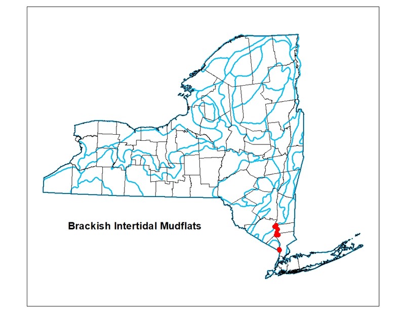
New York State Distribution
Restricted to brackish portions of estuaries of the northeastern Atlantic coast. Currently mapped from the Hudson River in Dutchess, Orange, Putnam, Rockland, and Westchester Counties. It probably also occurs in the coastal lowlands in Suffolk County. New York is at the central-southern part of the range, which is from New England possibly to New Jersey.
Global Distribution
This community occurs along the Atlantic coast from Maine to Virginia and possibly to South Carolina.
Best Places to See
- Hudson Highlands State Park (Putnam County)
- Tallman Mountain State Park (Rockland County)
- Bear Mountain State Park (Orange, Rockland Counties)
Identification Comments
General Description
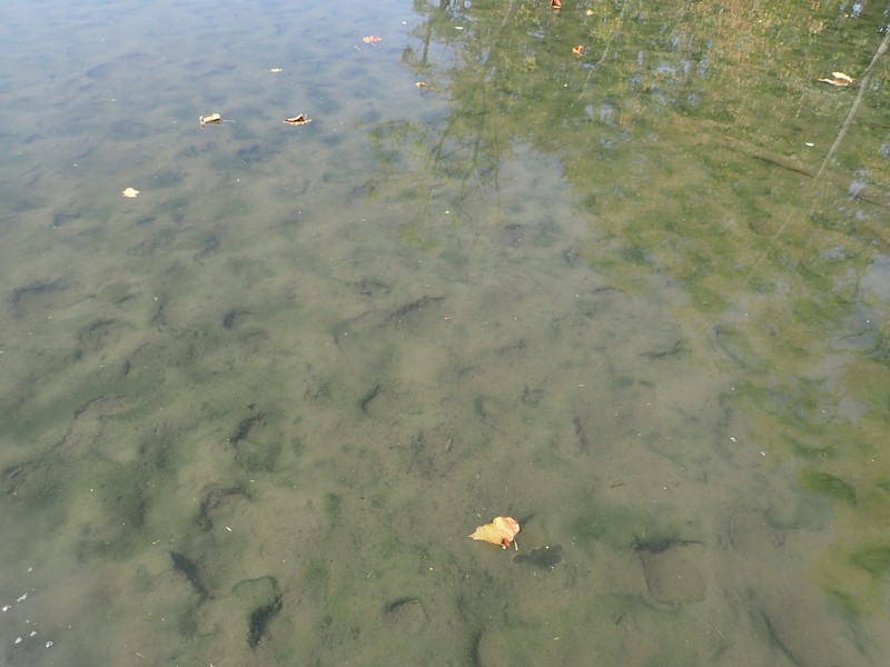
Brackish intertidal mudflat communities occur on exposed intertidal mudflats in which the salinity ranges from 0.5 to 18 parts per thousand (ppt). The vegetation is usually sparse, and consists of aquatic species such as spongy arrowhead (Sagittaria montevidensis), strap-leaf arrowhead (Sagittaria subulata), mudwort (Limosella australis), and tapegrass (Vallisneria americana). The community is completely submerged at high tide, and completely exposed at low tide.
Characters Most Useful for Identification
A sparsely-vegetated intertidal community on exposed mudflats where salinity ranges from 0.5 to 18 ppt. This community, which typically has low-growing rosette-leaved plants, is submerged during high tide, and exposed at low tide.
Elevation Range
Known examples of this community have been found at elevations between -1 feet and 3 feet.
Best Time to See
The low-growing rosette-leaved aquatic plants that are characteristic of brackish intertidal mudflats are best observed during the growing season at low tide.
Brackish Intertidal Mudflats Images
Troy Weldy
Troy Weldy
Troy Weldy
Troy Weldy
Gregory J. Edinger
Gregory J. Edinger
Classification
International Vegetation Classification Associations
This New York natural community encompasses all or part of the concept of the following International Vegetation Classification (IVC) natural community associations. These are often described at finer resolution than New York's natural communities. The IVC is developed and maintained by NatureServe.
- Shore Quillwort Tidal Marsh (CEGL006058)
- Awl-leaf Arrowhead - Welsh Mudwort Tidal Marsh (CEGL004473)
NatureServe Ecological Systems
This New York natural community falls into the following ecological system(s). Ecological systems are often described at a coarser resolution than New York's natural communities and tend to represent clusters of associations found in similar environments. The ecological systems project is developed and maintained by NatureServe.
- Atlantic Coastal Plain Embayed Region Tidal Freshwater Marsh (CES203.259)
- Northern Atlantic Coastal Plain Brackish Tidal Marsh (CES203.894)
- Northern Atlantic Coastal Plain Fresh and Oligohaline Tidal Marsh (CES203.516)
Characteristic Species
-
Emergent aquatics
- Schoenoplectus americanus (chair-maker's bulrush)
-
Submerged aquatics
- Ceratophyllum demersum (common coon-tail)
- Filamentous algae
- Green algae
- Limosella australis (Atlantic mudwort)
- Potamogeton crispus (curly pondweed)
- Sagittaria montevidensis ssp. spongiosa (spongy-leaved arrowhead)
- Sagittaria subulata (awl-leaved arrowhead)
- Vallisneria americana (water-celery, tape-grass)
- Zannichellia palustris (horned pondweed)
Similar Ecological Communities
- Brackish intertidal shore
Brackish intertidal shore communities occur along intertidal rocky or gravelly shores, rather than on intertidal mudflats.
- Brackish subtidal aquatic bed
(guide)
Brackish subtidal aquatic bed communities are subtidal (continuously flooded) and are charactertized by floating and submerged aquatic vegetation such as sago pondweed (Stuckenia pectinata), widgeon grass (Ruppia maritimia), and naiad (Najas guadalupensis). Brackish intertidal mudflats are intertidal (flooded and exposed with the tide).
- Brackish tidal marsh
(guide)
Brackish tidal marshes and brackish intertidal mudflats are often adjacent to each other, or can form a patchy mosaic within an embayment or creek mouth. Both communities are influenced by diurnal tides and often have similar muddy substrates. However, brackish intertidal mudflats are sparsely vegetated by low-growing rosette leaved aquatics (e.g., Sagittaria montevidensis ssp. spongiosa, Sagittaria subulata), compared to brackish tidal marshes that are typically dominated by narrow-leaved cattail (Typha angustifolia).
- Freshwater intertidal mudflats
(guide)
Freshwater intertidal mudflats are intertidal communities that have salinity values less than 0.5 ppt, whereas brackish intertidal mudflats have salinity values that are higher (0.5 to 18 ppt). Freshwater intertidal communities are located upstream from brackish intertidal communities.
- Freshwater intertidal shore
(guide)
Freshwater intertidal shore communities occur along intertidal rocky or gravelly shores, and have salinity values less than 0.5 ppt. Brackish intertidal mudflats have silt and mud substrate and have salinity values that are higher (0.5 to 18 ppt). Freshwater intertidal communities are located upstream from brackish intertidal communities.
- Marine intertidal mudflats
(guide)
While both communities have silt and mud substrate, marine intertidal mudflats are a marine community, rather than an estuarine community; therefore, this intertidal community has salinity values greater than 18 ppt. Brackish intertidal mudflats are located farther upstream and have salinity values that are lower (0.5 to 18 ppt).
Vegetation
Percent cover
This figure helps visualize the structure and "look" or "feel" of a typical Brackish Intertidal Mudflats. Each bar represents the amount of "coverage" for all the species growing at that height. Because layers overlap (shrubs may grow under trees, for example), the shaded regions can add up to more than 100%.
Additional Resources
References
Edinger, G. J., D. J. Evans, S. Gebauer, T. G. Howard, D. M. Hunt, and A. M. Olivero (editors). 2014. Ecological Communities of New York State. Second Edition. A revised and expanded edition of Carol Reschke’s Ecological Communities of New York State. New York Natural Heritage Program, New York State Department of Environmental Conservation, Albany, NY. https://www.nynhp.org/ecological-communities/
Edinger, Gregory J., D.J. Evans, Shane Gebauer, Timothy G. Howard, David M. Hunt, and Adele M. Olivero (editors). 2002. Ecological Communities of New York State. Second Edition. A revised and expanded edition of Carol Reschke's Ecological Communities of New York State. (Draft for review). New York Natural Heritage Program, New York State Department of Environmental Conservation. Albany, NY. 136 pp.
Kiviat, Erik and Gretchen Stevens. 2001. Biodiversity assessment manual for the Hudson River Estuary Corridor. New York State Department of Environmental Conservation. Albany, NY.
MacDonald, Dana and Gregory Edinger. 2000. Identification of reference wetlands on Long Island, New York. Final report prepared for the Environmental Protection Agency, Wetland Grant CD992436-01. New York Natural Heritage Program, New York State Department of Environmental Conservation. Latham, NY. 106 pp. plus appendices.
Metzler, K. and R. Rosza. 1982. Vegetation of fresh and brackish tidal marshes in Connecticut. Newsletter of the Connecticut Botanical Society 10(1): 1-3.
Muenscher, W.C. 1937. VII. Aquatic vegetation of the Lower Hudson area. 1936. Biological Survey. 11:231-248.
New York Natural Heritage Program. 2024. New York Natural Heritage Program Databases. Albany, NY.
Reschke, Carol. 1990. Ecological communities of New York State. New York Natural Heritage Program, New York State Department of Environmental Conservation. Latham, NY. 96 pp. plus xi.
Links
About This Guide
This guide was authored by: Aissa Feldmann
Information for this guide was last updated on: December 14, 2023
Please cite this page as:
New York Natural Heritage Program. 2024.
Online Conservation Guide for
Brackish intertidal mudflats.
Available from: https://guides.nynhp.org/brackish-intertidal-mudflats/.
Accessed July 26, 2024.