Red Maple-Tamarack Peat Swamp
Red maple-tamarack peat swamp
D.J. Evans
- System
- Palustrine
- Subsystem
- Forested Peatlands
- State Protection
- Not Listed
Not listed or protected by New York State.
- Federal Protection
- Not Listed
- State Conservation Status Rank
- S2S3
Imperiled or Vulnerable in New York - Very vulnerable, or vulnerable, to disappearing from New York, due to rarity or other factors; typically 6 to 80 populations or locations in New York, few individuals, restricted range, few remaining acres (or miles of stream), and/or recent and widespread declines. More information is needed to assign either S2 or S3.
- Global Conservation Status Rank
- G3G4
Vulnerable globally, or Apparently Secure - At moderate risk of extinction, with relatively few populations or locations in the world, few individuals, and/or restricted range; or uncommon but not rare globally; may be rare in some parts of its range; possibly some cause for long-term concern due to declines or other factors. More information is needed to assign either G3 or G4.
Summary
Did you know?
Unlike most conifers such as pine and spruce, tamarack is deciduous and loses its leaves in the fall like maples and oaks. Other conifers lose their leaves too, but in a different way. A small portion of "evergreen" leaves (needles) are shed continuously throughout the entire year, while tamaracks and other deciduous trees lose all of their leaves at once.
State Ranking Justification
There are several hundred occurrences statewide. A few documented occurrences have good viability and several are protected on public land or private conservation land. This community is sparsely scattered but widespread throughout upstate New York, and includes a several large, high quality examples. The current trend of this community is probably stable for occurrences on public land, or declining slightly elsewhere due to moderate threats that include alteration of the natural hydrology (primarily by beaver) and invasive species.
Short-term Trends
The number and acreage of red maple-tamarack peat swamps in New York have probably declined slightly, or have remained stable, in recent decades as a result of wetland protection regulations. A few examples may have declined due to flooding by beaver.
Long-term Trends
The number and acreage of red maple-tamarack peat swamps in New York have probably declined substantially from historical numbers likely correlated with agricultural and other development.
Conservation and Management
Threats
Red maple-tamarack peat swamps are threatened by development (e.g., agriculture, residential, roads, railroads) and habitat alteration (e.g., excessive logging, sediment and pollution run-off). Alteration to the natural hydrological regime is also a threat to this community (e.g., impoundments, blocked culverts, beaver). A few swamps are threatened by nearby mining operations (e.g., gravel and peat removal). Several red maple-tamarack peat swamps are threatened by invasive species, such as purple loosestrife (Lythrum salicaria), reedgrass (Phragmites australis ssp. australis), and buckthorn (Frangula alnus).
Conservation Strategies and Management Practices
Where practical, establish and maintain a natural wetland buffer to reduce storm-water, pollution, and nutrient run-off, while simultaneously capturing sediments before they reach the wetland. Buffer width should take into account the erodibility of the surrounding soils, slope steepness, and current land use. Wetlands protected under Article 24 are known as New York State "regulated" wetlands. The regulated area includes the wetlands themselves, as well as a protective buffer or "adjacent area" extending 100 feet landward of the wetland boundary (NYS DEC 1995). If possible, minimize the number and size of impervious surfaces in the surrounding landscape. Avoid habitat alteration within the wetland and surrounding landscape. For example, roads and trails should be routed around wetlands, and ideally should not pass through the buffer area. If the wetland must be crossed, then bridges and boardwalks are preferred over filling. Restore swamps affected by unnatural disturbance (e.g., remove obsolete impoundments and ditches in order to restore the natural hydrology). Prevent the spread of invasive exotic species into the wetland through appropriate direct management, and by minimizing potential dispersal corridors, such as roads.
Development and Mitigation Considerations
When considering road construction and other development activities minimize actions that will change what water carries and how water travels to this community, both on the surface and underground. Water traveling over-the-ground as run-off usually carries an abundance of silt, clay, and other particulates during (and often after) a construction project. While still suspended in the water, these particulates make it difficult for aquatic animals to find food; after settling to the bottom of the wetland, these particulates bury small plants and animals and alter the natural functions of the community in many other ways. Thus, road construction and development activities near this community type should strive to minimize particulate-laden run-off into this community. Water traveling on the ground or seeping through the ground also carries dissolved minerals and chemicals. Road salt, for example, is becoming an increasing problem both to natural communities and as a contaminant in household wells. Fertilizers, detergents, and other chemicals that increase the nutrient levels in wetlands cause algae blooms and eventually an oxygen-depleted environment where few animals can live. Herbicides and pesticides often travel far from where they are applied and have lasting effects on the quality of the natural community. So, road construction and other development activities should strive to consider: 1. how water moves through the ground, 2. the types of dissolved substances these development activities may release, and 3. how to minimize the potential for these dissolved substances to reach this natural community.
Inventory Needs
Survey for occurrences statewide to advance documentation and classification of red maple-tamarack peat swamps. A statewide review of red maple-tamarack peat swamps is desirable. Continue searching for large sites in good condition especially those over 100 acres.
Research Needs
Research composition of red maple-tamarack peat swamps statewide in order to characterize variations. Collect sufficient plot data to support the recognition of several distinct types based on composition and by ecoregion.
Rare Species
- Betula pumila (Swamp Birch) (guide)
- Carex buxbaumii (Brown Bog Sedge) (guide)
- Carex gynocrates (Northern Bog Sedge) (guide)
- Carex sartwellii (Sartwell's Sedge) (guide)
- Carex schweinitzii (Schweinitz's Sedge) (guide)
- Carex vaginata (Sheathed Sedge) (guide)
- Chamaelirium luteum (Fairywand) (guide)
- Glyptemys muhlenbergii (Bog Turtle) (guide)
- Haliaeetus leucocephalus (Bald Eagle) (guide)
- Neottia bifolia (Southern Twayblade) (guide)
- Petasites frigidus var. palmatus (Sweet Coltsfoot) (guide)
- Poa paludigena (Slender Marsh Blue Grass) (guide)
- Polemonium vanbruntiae (Jacob's Ladder) (guide)
- Pyrola asarifolia ssp. asarifolia (Pink Shinleaf) (guide)
- Solidago ohioensis (Ohio Goldenrod) (guide)
- Symphyotrichum boreale (Northern Bog Aster) (guide)
- Trollius laxus (Spreading Globeflower) (guide)
- Valeriana uliginosa (Marsh Valerian) (guide)
- Vittaria appalachiana (Appalachian Shoestring Fern) (guide)
Range
New York State Distribution
This community is sparsely scattered but widespread throughout upstate New York, north of the North Atlantic Coast Ecoregion. It is concentrated in the Great Lakes Ecoregion and very uncommon in the Northern Appalachians Ecoregion.
Global Distribution
This community is limited to the Great Lakes basin and adjacent areas. This range is estimated to span north to central Ontario, west to Minnesota, southwest to northern Indiana, southeast possibly to western Massachusetts, and northeast to Newfoundland.
Best Places to See
- Deer Creek Marsh Wildlife Management Area (Oswego County)
- French Creek Wildlife Management Area (Jefferson County)
- Lake Superior State Park (Sullivan County)
- Perch River Wildlife Management Area (Jefferson County)
- Catskill Park (Ulster County)
- Lake George Wild Forest, Adirondack Park (Warren County)
- Powder Mill Park (Monroe County)
- Happy Valley Wildlife Management Area (Oswego County)
Identification Comments
General Description
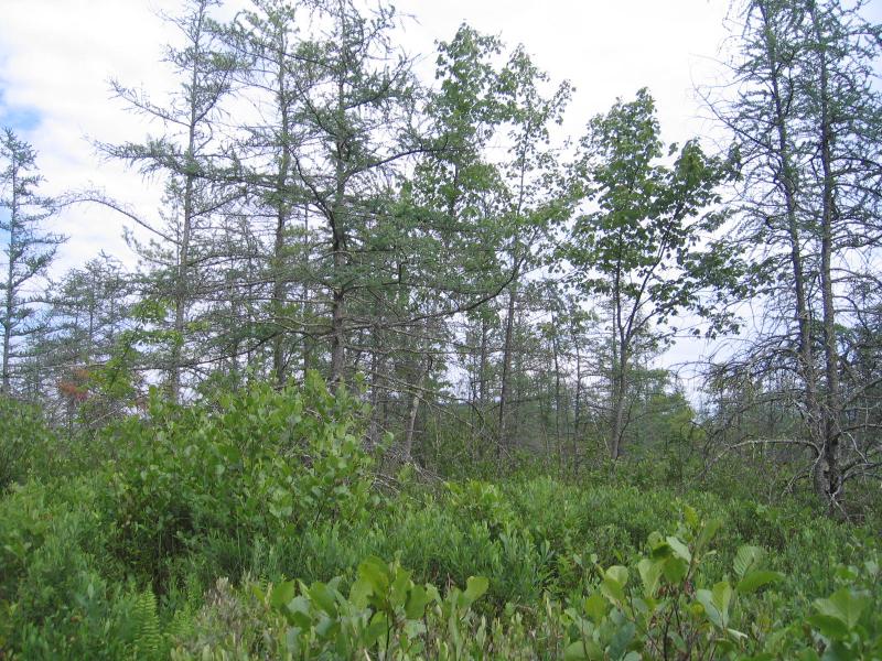
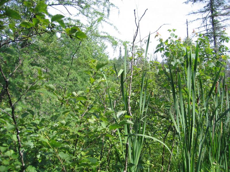
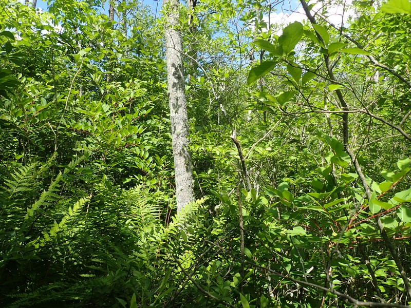
A mixed swamp that occurs on organic soils (peat or muck) in poorly drained depressions. The dominant trees are red maple (Acer rubrum) and tamarack (Larix laricina). These species usually form an open canopy (50 to 70% cover) with numerous small openings dominated by shrubs or sedges. The herb layer is often very diverse and usually includes calcium-rich indicator species. The bryophyte layer is dominated by several species of peat mosses (Sphagnum spp).
Characters Most Useful for Identification
A swamp that occurs on organic soils (peat or muck) in poorly drained depressions. Dominant canopy trees include both conifers and deciduous species; red maple and tamarack are characteristic.
Elevation Range
Known examples of this community have been found at elevations between 250 feet and 1,584 feet.
Best Time to See
Tamarack and red maple are characteristic of red maple-tamarack peat swamps; their striking look is best enjoyed in the growing season from May through September.
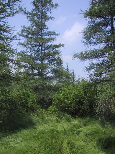
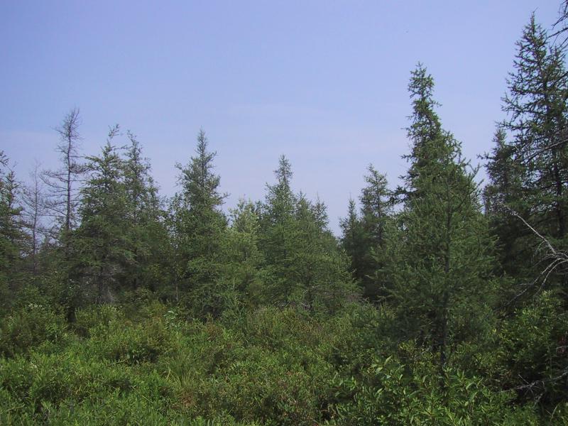
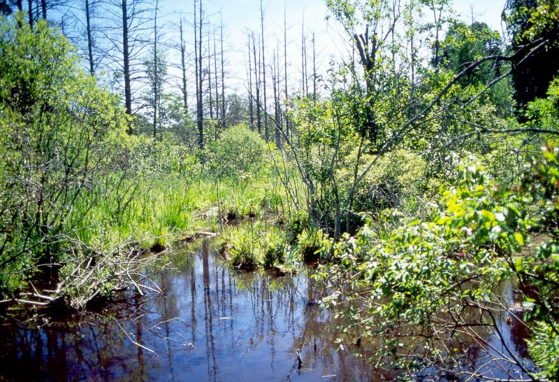
Red Maple-Tamarack Peat Swamp Images
D.J. Evans
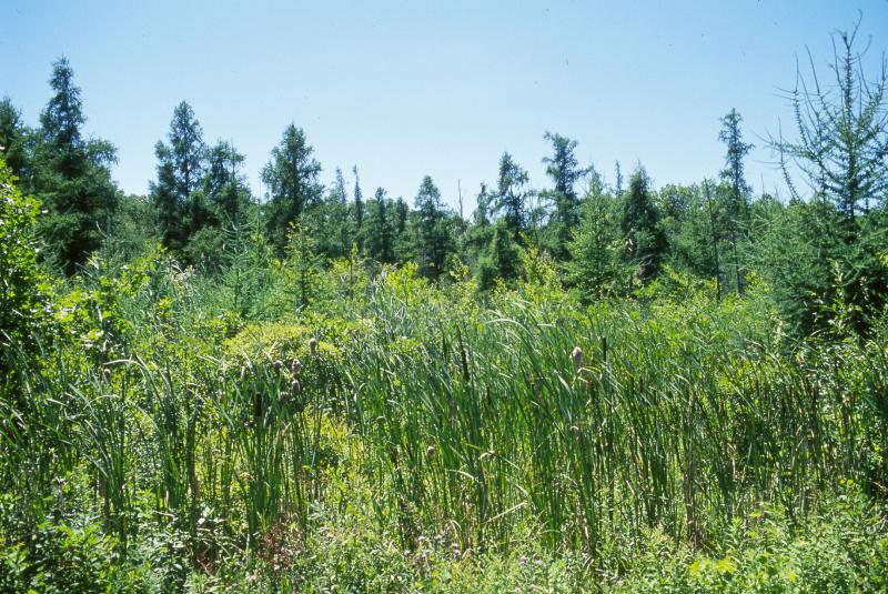
Stephen M. Young
D.J. Evans
Stephen M. Young
Gregory J. Edinger
Gregory J. Edinger
Gregory J. Edinger

Classification
International Vegetation Classification Associations
This New York natural community encompasses all or part of the concept of the following International Vegetation Classification (IVC) natural community associations. These are often described at finer resolution than New York's natural communities. The IVC is developed and maintained by NatureServe.
- Red Maple - Black Ash - (Tamarack) / Alderleaf Buckthorn Swamp Forest (CEGL006009)
NatureServe Ecological Systems
This New York natural community falls into the following ecological system(s). Ecological systems are often described at a coarser resolution than New York's natural communities and tend to represent clusters of associations found in similar environments. The ecological systems project is developed and maintained by NatureServe.
- North-Central Interior and Appalachian Rich Swamp (CES202.605)
Characteristic Species
-
Trees > 5m
- Acer rubrum var. rubrum (common red maple)
- Larix laricina (tamarack)
- Picea mariana (black spruce)
-
Shrubs 2 - 5m
- Alnus incana ssp. rugosa (speckled alder)
- Ilex mucronata (mountain holly)
- Ilex verticillata (common winterberry)
- Rhododendron viscosum (swamp azalea)
- Vaccinium corymbosum (highbush blueberry)
-
Shrubs < 2m
- Chamaedaphne calyculata (leatherleaf)
- Kalmia polifolia (bog laurel)
- Spiraea alba var. latifolia (broad-leaved meadow-sweet)
-
Herbs
- Calla palustris (wild calla)
- Carex lasiocarpa ssp. americana (slender bog sedge)
- Carex stricta (tussock sedge)
- Carex trisperma (three-fruited sedge)
- Galium spp.
- Leersia oryzoides (rice cut grass)
- Osmunda regalis var. spectabilis (royal fern)
- Osmundastrum cinnamomeum var. cinnamomeum (cinnamon fern)
- Packera aurea (golden ragwort)
- Rubus pubescens (dwarf raspberry)
- Solidago patula (rough-leaved goldenrod)
- Thelypteris palustris var. pubescens (marsh fern)
-
Nonvascular plants
- Sphagnum spp.
Similar Ecological Communities
- Red maple-hardwood swamp
(guide)
Red maple-hardwood swamps are mineral soil wetlands usually with mucky soils. If there is a peat layer present it is usually under 20 cm deep. Red maple-hardwood swamps are codominated by ash, elm, and birch with tamarack absent.
- Rich graminoid fen
(guide)
Rich graminoid fens are mineral-rich, often calcareous, peatlands that are dominated by sedges. Trees and shrubs, if present, make up much less than 50% cover.
- Rich shrub fen
(guide)
Rich shrub fens are mineral-rich peatlands dominated by shrubs. Red maple and tamarack, if present, are only present as saplings or small trees.
Vegetation
Percent cover
This figure helps visualize the structure and "look" or "feel" of a typical Red Maple-Tamarack Peat Swamp. Each bar represents the amount of "coverage" for all the species growing at that height. Because layers overlap (shrubs may grow under trees, for example), the shaded regions can add up to more than 100%.
Additional Resources
References
Cowardin, L.M., V. Carter, F.C. Golet, and E.T. La Roe. 1979. Classification of wetlands and deepwater habitats of the United States. U.S. Fish and Wildlife Service. Washington, D.C. 131 pp.
Edinger, G. J., D. J. Evans, S. Gebauer, T. G. Howard, D. M. Hunt, and A. M. Olivero (editors). 2014. Ecological Communities of New York State. Second Edition. A revised and expanded edition of Carol Reschke’s Ecological Communities of New York State. New York Natural Heritage Program, New York State Department of Environmental Conservation, Albany, NY. https://www.nynhp.org/ecological-communities/
Edinger, Gregory J., D.J. Evans, Shane Gebauer, Timothy G. Howard, David M. Hunt, and Adele M. Olivero (editors). 2002. Ecological Communities of New York State. Second Edition. A revised and expanded edition of Carol Reschke's Ecological Communities of New York State. (Draft for review). New York Natural Heritage Program, New York State Department of Environmental Conservation. Albany, NY. 136 pp.
McVaugh, R. 1958. Flora of the Columbia County area, New York. Bull. 360. New York State Museum and Science Service. University of the State of New York. Albany, NY. 400 pp.
New York Natural Heritage Program. 2024. New York Natural Heritage Program Databases. Albany, NY.
New York Natural Heritage Program. No date. Field forms database: Electronic field data storage and access for New York Heritage ecology, botany, and zoology. New York Natural Heritage Program, New York State Department of Environmental Conservation. Albany, NY.
New York State Department of Environmental Conservation. 1995. Freshwater Wetlands: Delineation Manual. July 1995. New York State Department of Environmental Conservation. Division of Fish, Wildlife, and Marine Resources. Bureau of Habitat. Albany, NY.
Reschke, Carol. 1990. Ecological communities of New York State. New York Natural Heritage Program, New York State Department of Environmental Conservation. Latham, NY. 96 pp. plus xi.
Links
About This Guide
This guide was authored by: Aissa Feldmann
Information for this guide was last updated on: May 16, 2024
Please cite this page as:
New York Natural Heritage Program. 2024.
Online Conservation Guide for
Red maple-tamarack peat swamp.
Available from: https://guides.nynhp.org/red-maple-tamarack-peat-swamp/.
Accessed July 27, 2024.