Rich Shrub Fen
Rich Shrub Fen
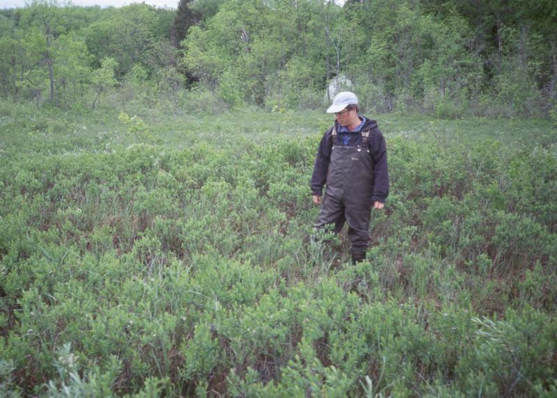
Carly Voight
- System
- Palustrine
- Subsystem
- Open Peatlands
- State Protection
- Not Listed
Not listed or protected by New York State.
- Federal Protection
- Not Listed
- State Conservation Status Rank
- S1S2
Critically Imperiled or Imperiled in New York - Especially or very vulnerable to disappearing from New York due to rarity or other factors; typically 20 or fewer populations or locations in New York, very few individuals, very restricted range, few remaining acres (or miles of stream), and/or steep declines. More information is needed to assign either S1 or S2.
- Global Conservation Status Rank
- G3G4
Vulnerable globally, or Apparently Secure - At moderate risk of extinction, with relatively few populations or locations in the world, few individuals, and/or restricted range; or uncommon but not rare globally; may be rare in some parts of its range; possibly some cause for long-term concern due to declines or other factors. More information is needed to assign either G3 or G4.
Summary
Did you know?
Poison sumac grows in rich shrub fens. Like poison ivy and poison oak, poison sumac contains the chemical urushiol, which can cause a skin rash upon contact by sensitive people. If ingested or inhaled, the urushiols attack the mucous membranes of mouth, nose, and intestines and can cause death. However, the fruit is non-toxic to, and is commonly eaten by, birds and other animals.
State Ranking Justification
There are about one hundred occurrences statewide. Some documented occurrences have good viability and several are protected on public land or private conservation land. This community is limited to the calcareous areas of the state and is restricted to wetlands that gain most of their moisture from underground sources that flow through calcareous substrates. There are a few large, high quality examples. Most sites are small and some are very disturbed. The current trend of this community is probably stable for occurrences on public land, or declining slightly elsewhere due to moderate threats related to development pressure or alteration to the natural hydrology.
Short-term Trends
The number and acreage of rich shrub fens in New York have probably remained stable (or have slightly declined) in recent decades as a result of wetland protection regulations.
Long-term Trends
The number and acreage of rich shrub fens in New York have probably declined substantially from historical numbers likely correlated with the onset of agricultural and residential development. While the historical range and number of occurrences are unknown, two-thirds of our currently known examples of this community are smaller than 11 acres. These small wetland patches are most likely to be filled or otherwise altered. Thus, we estimate that there are many fewer examples today than 100 years ago.
Conservation and Management
Threats
Agricultural and residential development pressures are the greatest threat to this community. Aside from direct mowing, tilling, or filling of these wetlands, non-point source pollution from adjacent agricultural and residential lands can significantly alter the water chemistry or hydrology of the natural community. Additional threats include other alterations to the local hydrology and invasion by non-native invasive exotic plants, especially purple loosestrife (Lythrum salicaria) and common reed (Phragmites australis ssp. australis).
Conservation Strategies and Management Practices
Consider how water flows around and into this wetland. As most of the water inputs are from underground, management for the prevention of altered water quality and quantity is particularly difficult for this natural community, but should be of the utmost priority. Projects that occur near this community must consider the proximity of the development to this wetland and the potential for changing how water flows, both aboveground and belowground, into this wetland. Terrestrial buffers provide nesting habitat for resident salamanders, frogs, and turtles, and additional food sources for locally nesting birds, and thus should be retained. Consultation with a hydrologist is important to determine patterns of run-off and underground water sources for the wetland; in addition, the construction of impervious surfaces that would rapidly deliver water to the wetland should be avoided. Rapid influxes of surface water dilute the limey, mineral rich waters, decrease the robustness of the native fen species, and increase the likelihood of invasion by non-native species.
Development and Mitigation Considerations
When considering road construction and other development activities minimize actions that will change what water carries and how water travels to this community, both on the surface and underground. Water traveling over-the-ground as run-off usually carries an abundance of silt, clay, and other particulates during (and often after) a construction project. While still suspended in the water, these particulates make it difficult for aquatic animals to find food; after settling to the bottom of the wetland, these particulates bury small plants and animals and alter the natural functions of the community in many other ways. Thus, road construction and development activities near this community type should strive to minimize particulate-laden run-off into this community. Water traveling on the ground or seeping through the ground also carries dissolved minerals and chemicals. Road salt, for example, is becoming an increasing problem both to natural communities and as a contaminant in household wells. Fertilizers, detergents, and other chemicals that increase the nutrient levels in wetlands cause algae blooms and eventually an oxygen-depleted environment where few animals can live. Herbicides and pesticides often travel far from where they are applied and have lasting effects on the quality of the natural community. So, road construction and other development activities should strive to consider: 1. how water moves through the ground, 2. the types of dissolved substances these development activities may release, and 3. how to minimize the potential for these dissolved substances to reach this natural community.
Inventory Needs
Additional inventory efforts in regions with calcareous bedrock and promising wetlands will likely turn up a few additional sites. Re-inventories of known sites will provide important information to help assess short- and long-term changes. Survey fens that provide habitat for rare species. For example, extant bog turtle sites should be surveyed to determine the type and quality of the natural community if it is unknown.
Research Needs
Research better ways to accurately and efficiently measure and understand groundwater hydrology of fens. Further research into determining the proportion of fen water inputs is needed (e.g., groundwater vs. surface). If a fen is strongly groundwater influenced, traditional wetland buffers aimed at reducing surface water run-off may not sufficiently protect fen groundwater hydrology.
Rare Species
- Arethusa bulbosa (Dragon's Mouth Orchid) (guide)
- Betula pumila (Swamp Birch) (guide)
- Calamagrostis stricta (Northern Reed Grass) (guide)
- Calypso bulbosa var. americana (Calypso) (guide)
- Carex buxbaumii (Brown Bog Sedge) (guide)
- Carex chordorrhiza (Creeping Sedge) (guide)
- Carex gynocrates (Northern Bog Sedge) (guide)
- Carex meadii (Mead's Sedge) (guide)
- Carex sartwellii (Sartwell's Sedge) (guide)
- Carex schweinitzii (Schweinitz's Sedge) (guide)
- Carex tenuiflora (Sparse-flowered Sedge) (guide)
- Cirriphyllum piliferum (Hair-pointed Moss) (guide)
- Cypripedium candidum (Small White Lady's Slipper) (guide)
- Glyptemys muhlenbergii (Bog Turtle) (guide)
- Myurella julacea (Small Mousetail Moss) (guide)
- Pseudocalliergon turgescens (Curving Feather Moss) (guide)
- Pycnanthemum verticillatum var. verticillatum (Whorled Mountain Mint) (guide)
- Sparganium natans (Small Bur-reed) (guide)
- Sphagnum andersonianum (Anderson's Peat Moss) (guide)
- Sphagnum subfulvum (Pale Peat Moss) (guide)
- Symphyotrichum boreale (Northern Bog Aster) (guide)
- Triglochin palustris (Marsh Arrow Grass) (guide)
- Trollius laxus (Spreading Globeflower) (guide)
- Valeriana uliginosa (Marsh Valerian) (guide)
- Viola nephrophylla (Northern Bog Violet) (guide)
Range
New York State Distribution
This community is currently known from the Hudson Valley, the St. Lawrence Valley, and scattered locations within the limestone belt that runs from Albany to Niaraga Falls. Additional occurrences may be located elsewhere in the state where similar environmental conditions are present.
Global Distribution
The physically broadly-defined community may be widespread in areas of the United States and worldwide with calcareous peats. Examples with the greatest biotic affinities to New York occurrences are suspected to extend north into Ontario, south to the Central Appalachians of North Carolina and Tennessee, west to Wisconsin and Iowa, east to western New England, and northeast to New Brunswick. Few examples are suspected east of the Appalachian Divide, where the bedrock is mostly acidic.
Best Places to See
- Bonaparte Swamp Preserve (Lewis County)
- Preechy Hollow, Taconic State Park
- Perch River Swamp, Perch River WMA (Jefferson County)
- Great Swamp Preserve
- Mendon Ponds Park (Monroe County)
Identification Comments
General Description
A strongly minerotrophic peatland in which the substrate is a woody peat, which may or may not be underlain by marl or limestone bedrock. Rich fens are fed by waters that have high concentrations of minerals and high pH values, generally from 6.0 to 7.8. The dominant species in rich shrub fens are shrubs, which form a canopy and overtop most herbs. Some rich shrub fens are dominated by low shrubs (under 4 ft or 1.2 m) that collectively have 80 to 90% cover in the community. Other rich shrub fens are dominated by taller shrubs (over 4 ft or 1.2 m) that collectively have 50 to 70% cover in the community with low shrubs and graminoids locally dominant in openings. The rich shrub fen community is somewhat broadly defined to include both the low shrub and taller shrub examples as well as regional variants distinguished by variations in their flora such as the lack of shrubby cinquefoil (Dasiphora fruticosa ssp. floribunda) in northern examples. In rich shrub fens, peat mosses (Sphagnum spp.) are either absent or a minor component, with only the most minerotrophic species present. Other mosses may be common.
Characters Most Useful for Identification
Look for sites that seem to be wet from groundwater, not from adjacent streams or ponds. A typical example has a high abundance of shrubs that like such "rich" or "sweet" water. Characteristic shrubs and small trees include red maple (Acer rubrum), red osier dogwood (Cornus sericea), speckled alder (Alnus incana ssp. rugosa), sweet-gale (Myrica gale), shrubby cinquefoil (Dasiphora fruticosa ssp. floribunda), swamp fly honeysuckle (Lonicera oblongifolia), black chokeberry (Photinia melanocarpa), alder-leaf buckthorn (Rhamnus alnifolia), and poison sumac (Toxicodendron vernix). Characteristic herbs include marsh fern (Thelypteris palustris), royal fern (Osmunda regalis), sedges (Carex stricta, C. interior), common cat-tail (Typha latifolia), bluejoint grass (Calamagrostis canadensis), tall meadow-rue (Thalictrum pubescens), water horsetail (Equisetum fluviatile), and marsh St. John's-wort (Triadenum virginicum). Characteristic nonvascular species include the mosses Brachythecium oedipodium, Campylium polygamum, Eurhynchium pulchellum, Helodium blandowii, Scorpidium cossonii, the rare scorpion feather moss (Scorpidium scorpioides), the peat moss Sphagnum teres, the leafy liverwort Calypogeia sphagnicola, and the thalloid liverworts Pallavicinia lyellii and Pellia epiphylla. The moss Calliergon giganteum becomes characteristically abundant in this community. Additional rich shrub fen bryophytes common to other rich fen types include the mosses Aulacomnium palustre, Bryum pseudotriquetrum, Calliergonella cuspidata, Campylium stellatum, Cratoneuron filicinum, Fissidens adianthoides, the peat moss Sphagnum warnstorfii, the rare golden moss (Tomentypnum nitens), and the thalloid liverwort Aneura pinguis.
Elevation Range
Known examples of this community have been found at elevations between 230 feet and 770 feet.
Best Time to See
One of the best times to visit this community is when the showy yellow flowers of shrubby cinquefoil are in full bloom, usually from mid July to mid August.
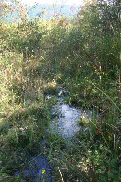
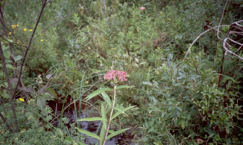
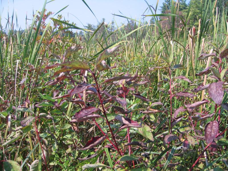
Rich Shrub Fen Images
Carly Voight
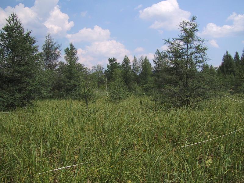
Adele M. Olivero
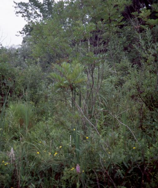
D.J. Evans
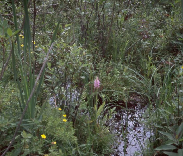
D.J. Evans
Adele M. Olivero
D.J. Evans
Gregory J. Edinger
Classification
International Vegetation Classification Associations
This New York natural community encompasses all or part of the concept of the following International Vegetation Classification (IVC) natural community associations. These are often described at finer resolution than New York's natural communities. The IVC is developed and maintained by NatureServe.
- Bog Birch - Gray Alder - Willow species / Leatherleaf Fen (CEGL005227)
- Bog Birch - Poison-sumac - Shrubby-cinquefoil Fen (CEGL006360)
- Silky Dogwood - Sageleaf Willow / Shrubby-cinquefoil / Upright Sedge Fen (CEGL006359)
- Red-osier Dogwood - Silky Dogwood - Black Chokeberry - Nannyberry Fen (CEGL005088)
- Dogwood species - Willow species - Highbush Blueberry - Alderleaf Buckthorn - Poison-sumac Fen (CEGL005083)
- Shrubby-cinquefoil / Inland Sedge - Yellow Sedge - Fen Grass-of-Parnassus Fen (CEGL005140)
- Shrubby-cinquefoil / Woolly-fruit Sedge / Star Campylium Moss Fen (CEGL006525)
NatureServe Ecological Systems
This New York natural community falls into the following ecological system(s). Ecological systems are often described at a coarser resolution than New York's natural communities and tend to represent clusters of associations found in similar environments. The ecological systems project is developed and maintained by NatureServe.
- Laurentian-Acadian Alkaline Fen (CES201.585)
Characteristic Species
-
Trees > 5m
- Acer rubrum var. rubrum (common red maple)
-
Shrubs 2 - 5m
- Alnus incana ssp. rugosa (speckled alder)
- Fraxinus pennsylvanica (green ash)
- Toxicodendron vernix (poison-sumac)
-
Shrubs < 2m
- Alnus incana ssp. rugosa (speckled alder)
- Cornus amomum ssp. amomum (silky dogwood)
- Cornus sericea (red-osier dogwood)
- Dasiphora fruticosa (shrubby-cinquefoil)
- Ilex verticillata (common winterberry)
- Larix laricina (tamarack)
- Lonicera oblongifolia (swamp fly honeysuckle)
- Rhamnus alnifolia (alder-leaved buckthorn)
- Salix candida (sage-leaved willow)
- Viburnum dentatum var. lucidum (smooth arrowwood)
-
Herbs
- Calamagrostis canadensis var. canadensis (Canada bluejoint grass)
- Carex flava (yellow sedge)
- Carex interior (inland sedge)
- Carex lacustris (lake-bank sedge)
- Iris versicolor (blue flag)
- Osmunda regalis var. spectabilis (royal fern)
- Parnassia glauca (common grass-of-Parnassus)
- Symplocarpus foetidus (skunk-cabbage)
- Thelypteris palustris var. pubescens (marsh fern)
-
Nonvascular plants
- Calliergonella cuspidata
Similar Ecological Communities
- Dwarf shrub bog
(guide)
Rich shrub fens have rich indicator shrubs, such as alderleaf buckthorn (Rhamnus alnifolia), shrubby cinquefoil (Dasiphora floribunda), poison sumac (Toxicodendron vernix), hoary willow (Salix candida), and bog birch (Betula pumila). Whereas, dwarf shrub bogs are acidic peatlands and thus have shrubs that are adapted to growing under low nutrient conditions, such as leatherleaf (Chamaedaphne calyculata), Labrador tea (Rhododendron groenlandicum), and bog laurel (Kalmia polifolia).
- Inland poor fen
(guide)
Inland poor fens are dominated by taller sedges and other herbs that overtop the short shrubs, such as leatherleaf (Chamaedaphne calyculata), and the peat is more acidic (pH 3.5-5.0) than rich shrub fens (pH 6.0-7.8). Rich shrub fens are dominated (50% cover or more) by rich indicator shrubs, such as alderleaf buckthorn (Rhamnus alnifolia), shrubby cinquefoil (Dasiphora floribunda), poison sumac (Toxicodendron vernix), hoary willow (Salix candida), and bog birch (Betula pumila).
- Medium fen
(guide)
Rich shrub fens have richer (more calcareous-loving) indicator species. Medium fens are dominated by American woollyfruit sedge (Carex lasiocarpa ssp. americana) and sweet gale (Myrica gale) with leatherleaf (Chamaedaphne calyculata) as a codominant, or minor associate. Rich shrub fens tend to have slightly higher pHs (6.0 to 7.8 versus 4.5 to 6.5) than medium fens.
- Rich graminoid fen
(guide)
Rich shrub fens have at least 50% shrub cover; rich graminoid fens have less than 50% cover of shrubs.
- Shrub swamp
(guide)
Rich shrub fens have a peat substrate; shrub swamps are on mineral soil.
Vegetation
Percent cover
This figure helps visualize the structure and "look" or "feel" of a typical Rich Shrub Fen. Each bar represents the amount of "coverage" for all the species growing at that height. Because layers overlap (shrubs may grow under trees, for example), the shaded regions can add up to more than 100%.
Additional Resources
References
Andrus, R.E. 1980. Sphagnaceae (Peat Moss Family) of New York State. Bulletin No. 442. New York State Museum. Albany, NY.
Bedford, B.L., M.R. Walbridge, and A. Aldous. 1999. Patterns in nutrient availability and plant diversity of temperate North American wetlands. Ecology 80:2151-2169.
Cowardin, L.M., V. Carter, F.C. Golet, and E.T. La Roe. 1979. Classification of wetlands and deepwater habitats of the United States. U.S. Fish and Wildlife Service. Washington, D.C. 131 pp.
Edinger, G. J., D. J. Evans, S. Gebauer, T. G. Howard, D. M. Hunt, and A. M. Olivero (editors). 2014. Ecological Communities of New York State. Second Edition. A revised and expanded edition of Carol Reschke’s Ecological Communities of New York State. New York Natural Heritage Program, New York State Department of Environmental Conservation, Albany, NY. https://www.nynhp.org/ecological-communities/
Edinger, Gregory J., D.J. Evans, Shane Gebauer, Timothy G. Howard, David M. Hunt, and Adele M. Olivero (editors). 2002. Ecological Communities of New York State. Second Edition. A revised and expanded edition of Carol Reschke's Ecological Communities of New York State. (Draft for review). New York Natural Heritage Program, New York State Department of Environmental Conservation. Albany, NY. 136 pp.
Godwin, K.S., J.P. Shallenberger, D.J. Leopold, and B.L. Bedford. 2002. Linking landscape properties to local hydrogeologic gradients and plant species occurrence in minerotrophic fens of New York State, USA: A hydrogeologic setting (HGS) framework. Wetlands 22:722-737.
Grossman, D. H., K. Lemon Goodin, and C. L. Reuss, editors. 1994. Rare plant communities of the conterminous United States: An initial survey. The Nature Conservancy. Arlington, VA. 620 pp.
Johnson, A.M. and D.J. Leopold. 1994. Vascular plant species richness and rarity across a minerotrophic gradient in wetlands of St. Lawrence County, New York, USA. Biodiversity Conserv. 3:606-627.
Langdon, Stephen F., M. Dovciak, and D.J. Leopold. 2020. Tree Encroachment Varies by Plant Community in a Large Boreal Peatland Complex in the Boreal-Temperate Ecotone of Northeastern USA. Wetlands. https://doi.org/10.1007/s13157-020-01319-z
Motzkin, G. 1994. Calcareous fens of western New England and adjacent New York State. Rhodora. 96(885): 44-68.
NatureServe. 2015. NatureServe Explorer: An online encyclopedia of life [web application]. Version 7.1. NatureServe, Arlington, Virginia. Available http://www.natureserve.org/explorer.
New York Natural Heritage Program. 2024. New York Natural Heritage Program Databases. Albany, NY.
New York Natural Heritage Program. No date. Field forms database: Electronic field data storage and access for New York Heritage ecology, botany, and zoology. New York Natural Heritage Program, New York State Department of Environmental Conservation. Albany, NY.
New York State Department of Environmental Conservation. 1995. Freshwater Wetlands: Delineation Manual. July 1995. New York State Department of Environmental Conservation. Division of Fish, Wildlife, and Marine Resources. Bureau of Habitat. Albany, NY.
Olivero, Adele M. 2001. Classification and Mapping of New York's Calcareous Fen Communities. A summary report prepared for the Nature Conservancy - Central/Western New York Chapter with funding from the Biodiversity Research Institute. New York Natural Heritage Program, New York State Department of Environmental Conservation. Albany, NY. 28 pp. plus nine appendices.
Olivero, Adele. 2002. Survey of Eastern New York's calcareous fens in the Mount Everett-Mount Riga landscape. A report prepared for the Nature Conservancy Eastern New York Chapter. New York Natural Heritage Program, New York State Department of Environmental Conservation. Albany, NY. 31 pp. plus appendices.
Reschke, Carol. 1990. Ecological communities of New York State. New York Natural Heritage Program, New York State Department of Environmental Conservation. Latham, NY. 96 pp. plus xi.
Slack, Nancy G. 1994. Can one tell the mire type from the bryophytes alone? J. Hattori Bot. Lab 75:149-159.
Links
About This Guide
This guide was authored by: Aissa Feldmann
Information for this guide was last updated on: November 13, 2023
Please cite this page as:
New York Natural Heritage Program. 2024.
Online Conservation Guide for
Rich shrub fen.
Available from: https://guides.nynhp.org/rich-shrub-fen/.
Accessed July 26, 2024.