Floodplain Forest
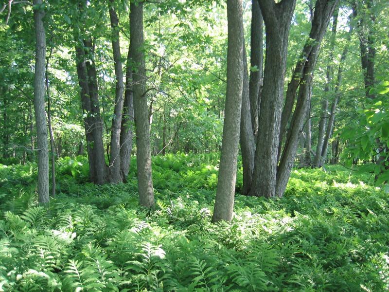
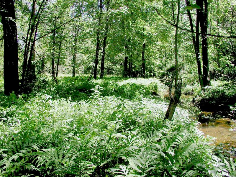
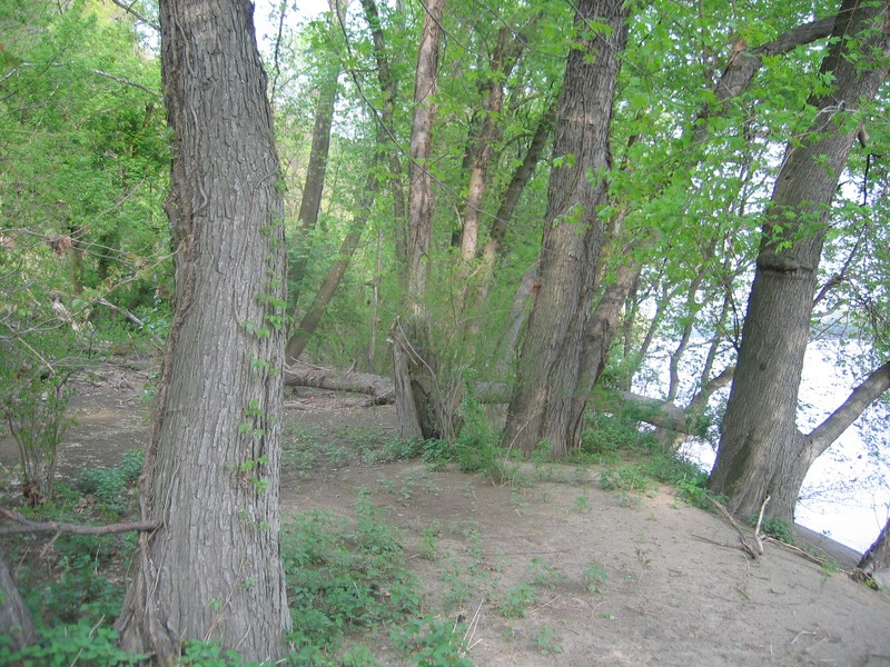
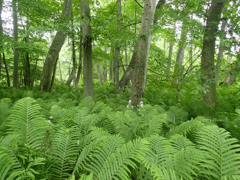
Floodplain forest at Saratoga National Historical Site (plot SBB1)
Gregory J. Edinger
- System
- Palustrine
- Subsystem
- Forested Mineral Soil Wetlands
- State Protection
- Not Listed
Not listed or protected by New York State.
- Federal Protection
- Not Listed
- State Conservation Status Rank
- S2S3
Imperiled or Vulnerable in New York - Very vulnerable, or vulnerable, to disappearing from New York, due to rarity or other factors; typically 6 to 80 populations or locations in New York, few individuals, restricted range, few remaining acres (or miles of stream), and/or recent and widespread declines. More information is needed to assign either S2 or S3.
- Global Conservation Status Rank
- G3G4
Vulnerable globally, or Apparently Secure - At moderate risk of extinction, with relatively few populations or locations in the world, few individuals, and/or restricted range; or uncommon but not rare globally; may be rare in some parts of its range; possibly some cause for long-term concern due to declines or other factors. More information is needed to assign either G3 or G4.
Summary
Did you know?
Floodplain forests once covered wide stretches along rivers in New York, yet only a tiny fraction of this original extent remains today. Minerals and other nutrients carried in rivers are deposited here after floods; these forests were among the first to be cleared because they produce very productive farmland. Urban expansion is also common along rivers, and floodplain forests are often cleared for such expansion and altered by flood control structures. They serve as an important wildlife corridor between habitats and reduce flooding and excessive siltation downstream. Floodplain forests are one of the few places you can find the green dragon (Arisaema dracontium), a jack-in-the-pulpit plant relative.
State Ranking Justification
There are several hundred occurrences statewide, although most are likely small and degraded. Some documented occurrences have good viability and many are protected on public land or private conservation land. This community is somewhat limited to the floodplains of large streams and rivers across the state, and includes a few very large, high quality, old-growth examples. The current trend of this community is probably stable for occurrences on public land and private conservation land, or declining slightly elsewhere due to moderate threats related to development pressure. This community has declined substantially from historical numbers likely correlated with past logging, agriculture, and other development.
Short-term Trends
The number and acreage of floodplain forests in New York have probably remained stable, or have slightly increased, in recent decades as a result of riparian protection regulations, floodplain restoration efforts, and agricultural abandonment followed by natural succession.
Long-term Trends
The number and acreage of floodplain forests in New York have substantially declined (about 50%) from historical numbers likely correlated with the onset of agricultural development of these areas. The number of floodplain forests may have increased slightly from historical numbers as formerly large matrix examples were fragmented by development into numerous large and small patches.
Conservation and Management
Threats
Historically, floodplain forests were cleared for agricultural purposes because of the mineral rich soil. Many examples were reduced to narrow bands along river shores. River floodplains provided logical sites for transportation corridors, as nearly every large stream and river in the state now has a parallel road, canal, and/or railroad. In recent decades, floodplains have been threatened by development (e.g., agriculture, residential, commercial), habitat alteration (e.g., clearing, excessive logging, pollution, dumping, utility ROWs), and recreational overuse (e.g., camp sites, hiking trails, fishing, boating, ATVs). Alteration to the natural seasonal flood regime is also a threat to this community (e.g., dikes, dredging, channelization, beaver).
Nearly all examples of floodplain forest are threatened by invasive species, such as garlic mustard (Alliaria petiolata), shrubby honeysuckles (Lonicera morrowii, L. tatarica), multiflora rose (Rosa multiflora), Japanese stilt grass (Microstegium vimineum), moneywort (Lysimachia nummularia), European stinging nettle (Urtica dioica ssp. dioica), dame’s rocket (Hesperis matronalis), and Japanese knotweed (Reynoutria japonica var. japonica). Non-native trees in some floodplain forests include white willow (Salix alba) and black locust (Robinia pseudoacacia).
The emerald ash borer (Agrilus planipennis) is an Asian beetle that infests and kills North American ash trees. All native ash trees are susceptible, including white ash, green ash, and black ash. In New York, emerald ash borer has been found mostly south of the Adirondack Mountains, but in 2017 it was recorded in Franklin and St. Lawrence Counties. Natural communities dominated or co-dominated by ash trees would likely be most impacted by emerald ash borer invasion.
Conservation Strategies and Management Practices
Prevent alterations to annual flood regime, and prevent logging and grazing within floodplain forests. Develop plans to remove or control invasive plants at high quality floodplain forests. Discontinue or limit land conversion and fragmentation activities within and around floodplain forests. Allow floodplain areas to recover from past human activity.
Development and Mitigation Considerations
The few remaining floodplain forests should be left intact to the extent possible, particularly because of their role in reducing floods elsewhere. Any constructed access to the river should maintain connectivity between the watercourse and the floodplain, and should minimize restrictions to high water flow throughout the floodplain. Maintain a full tree canopy throughout the floodplain forest and minimize edge effects on this forest by including an upland buffer of natural area (ideally forest) on the uphill side of the community. When considering road construction and other development activities, minimize actions that will change what water carries and how water travels to this community, both on the surface and underground. Water traveling over-the-ground as run-off usually carries an abundance of silt, clay, and other particulates during (and often after) a construction project. While still suspended in the water, these particulates make it difficult for aquatic animals to find food; after settling to the bottom of the wetland, these particulates bury small plants and animals and alter the natural functions of the community in many other ways. Thus, road construction and development activities near this community type should strive to minimize particulate-laden run-off into this community. Water traveling on the ground or seeping through the ground also carries dissolved minerals and chemicals. Road salt, for example, is becoming an increasing problem both to natural communities and as a contaminant in household wells. Fertilizers, detergents, and other chemicals that increase the nutrient levels in wetlands cause algae blooms and eventually an oxygen-depleted environment where few animals can live. Herbicides and pesticides often travel far from where they are applied and have lasting effects on the quality of the natural community. So, road construction and other development activities should strive to consider: 1. how water moves through the ground, 2. the types of dissolved substances these development activities may release, and 3. how to minimize the potential for these dissolved substances to reach this natural community.
Inventory Needs
Survey for occurrences statewide to advance documentation and classification of floodplain forests. A statewide review of floodplain forests is desirable, similar to the studies done in New Hampshire (Bechtel and Sperduto 1998, Nichols et al. 2000), Vermont (Sorenson et al. 1998), Massachusetts (Kearsley 1999), and Pennsylvania (Podniesinski and Wagner 2002). Continue searching for large sites in good condition especially those over 100 acres.
Research Needs
Research composition of floodplain forests statewide in order to characterize variations and how they correlate with flood regime and terrace elevation. Collect sufficient plot data to support the recognition of several distinct floodplain forest types based on composition, ecoregion, drainage, flood regime, and terrace elevation.
Rare Species
- Ardea herodias (Great Blue Heron) (guide)
- Blera pictipes (Painted Wood Fly) (guide)
- Botrychium oneidense (Blunt-lobed Grape Fern) (guide)
- Bromus nottowayanus (Satin Brome) (guide)
- Cardamine douglassii (Purple Spring Cress) (guide)
- Carex abscondita (Thicket Sedge) (guide)
- Carex amphibola (Ambiguous Sedge) (guide)
- Carex arcta (Northern Clustered Sedge) (guide)
- Carex conjuncta (Soft Fox Sedge) (guide)
- Carex davisii (Davis' Sedge) (guide)
- Carex jamesii (James' Sedge) (guide)
- Carex lupuliformis (False Hop Sedge) (guide)
- Carex mitchelliana (Mitchell's Sedge) (guide)
- Carex styloflexa (Bent Sedge) (guide)
- Carex typhina (Cat-tail Sedge) (guide)
- Carya laciniosa (Big Shellbark Hickory) (guide)
- Chaerophyllum procumbens (Spreading Chervil) (guide)
- Cornus drummondii (Rough-leaved Dogwood) (guide)
- Crotalus horridus (Timber Rattlesnake) (guide)
- Diarrhena obovata (Western Beakgrain) (guide)
- Erigenia bulbosa (Harbinger-of-spring) (guide)
- Haliaeetus leucocephalus (Bald Eagle) (guide)
- Hydrastis canadensis (Goldenseal) (guide)
- Jeffersonia diphylla (Twinleaf) (guide)
- Lithobates kauffeldi (Atlantic Coast Leopard Frog) (guide)
- Melanerpes erythrocephalus (Red-headed Woodpecker) (guide)
- Monarda clinopodia (Basilbalm) (guide)
- Myotis sodalis (Indiana Bat) (guide)
- Neottia auriculata (Auricled Twayblade) (guide)
- Papaipema sp. 2 nr. pterisii (Ostrich Fern Borer Moth) (guide)
- Protonotaria citrea (Prothonotary Warbler) (guide)
- Quercus phellos (Willow Oak) (guide)
- Senecio suaveolens (Sweet-scented Indian Plantain) (guide)
- Tachopteryx thoreyi (Gray Petaltail) (guide)
- Veronicastrum virginicum (Culver's Root) (guide)
- Vitis vulpina (Winter Grape) (guide)
Range
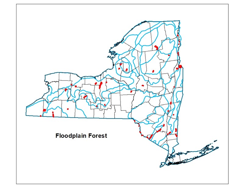
New York State Distribution
Large examples of this community are currently known from dozens of rivers and large streams across the state. Several high quality floodplain forests are known from the Upper Delaware Valley, the Central Hudson Valley, the Lake Champlain Valley, the Adirondack Mountains, the Mohawk Valley, the Lake Ontario Lake Plain, and across the High Allegheny Plateau.
Global Distribution
This physically and physiognomically broadly-defined community may be worldwide. Examples with the greatest biotic affinities to New York occurrences are suspected to span north to southern Canada, west to Minnesota, southwest to Indiana and Tennessee, southeast to Georgia and South Carolina, and northeast to Nova Scotia.
Best Places to See
- Neversink River Preserve (Orange County)
- East Bay Wildlife Management Area (Washington County)
- Schodack Island State Park (Greene, Rensselaer Counties)
- Conewango Swamp Wildlife Management Area
- Putts Creek Wildlife Management Area, Adirondack Park
- Jessup River Wild Forest, Adirondack Park (Hamilton County)
- Buttermilk Falls State Park (Tompkins County)
Identification Comments
General Description
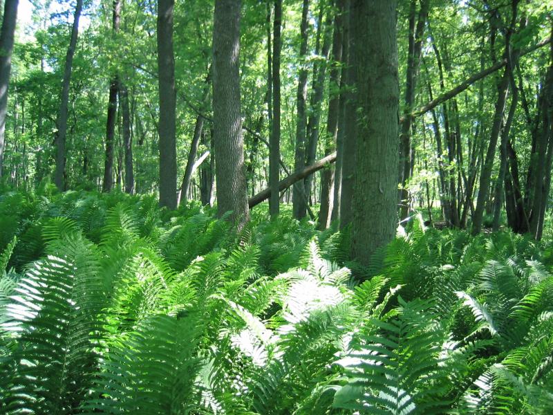
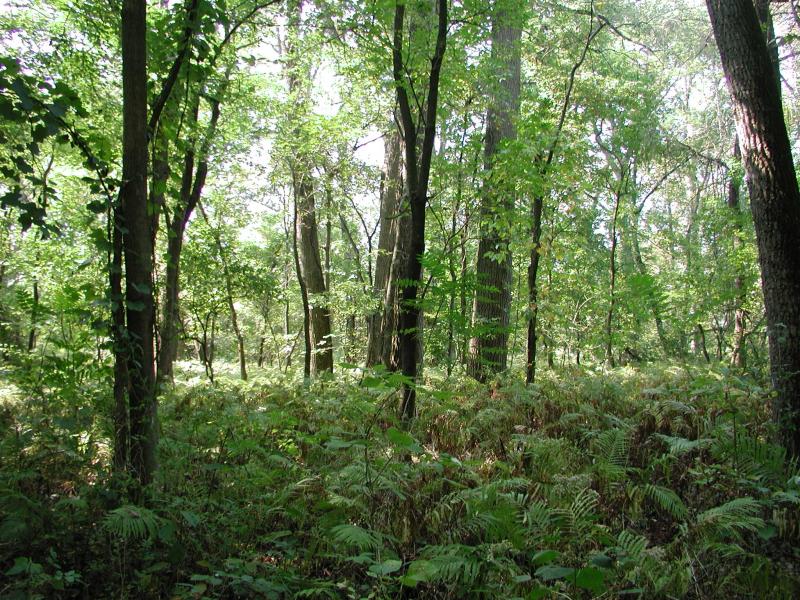
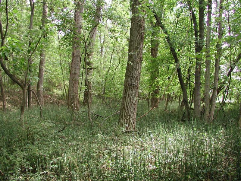
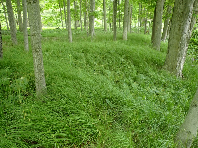
A hardwood forest that occurs on mineral soils on low terraces of river floodplains and river deltas. These sites are characterized by their flood regime; low areas are annually flooded in spring and high areas are flooded irregularly. This is a broadly defined community; floodplain forests are quite variable and may be very diverse. The composition of the forest apparently changes in relation to flood frequency and elevation of floodplain terraces along larger rivers.
Characters Most Useful for Identification
A hardwood forest that occurs on mineral soils on low terraces of river floodplains and river deltas. Species indicative of floodplains, such as bluejoint grass (Calamagrostis canadensis), jumpseed (Persicaria virginianum), smallspike false nettle (Boehmeria cylindrica), and nettles (Urtica spp.) should be more abundant than aquatic species. Other native species characteristic of floodplain forests include spotted jewelweed (Impatiens capensis), Canada goldenrod (Solidago canadensis), Virginia cutgrass (Leersia virginica), and possibly eastern cottonwood (Populus deltoides).
Elevation Range
Known examples of this community have been found at elevations between 6 feet and 1,657 feet.
Best Time to See
In the spring after a heavy rainstorm is an exciting time to witness the power and extent of a river at flood stage and how tolerant plants and animals inhabiting a floodplain must be.
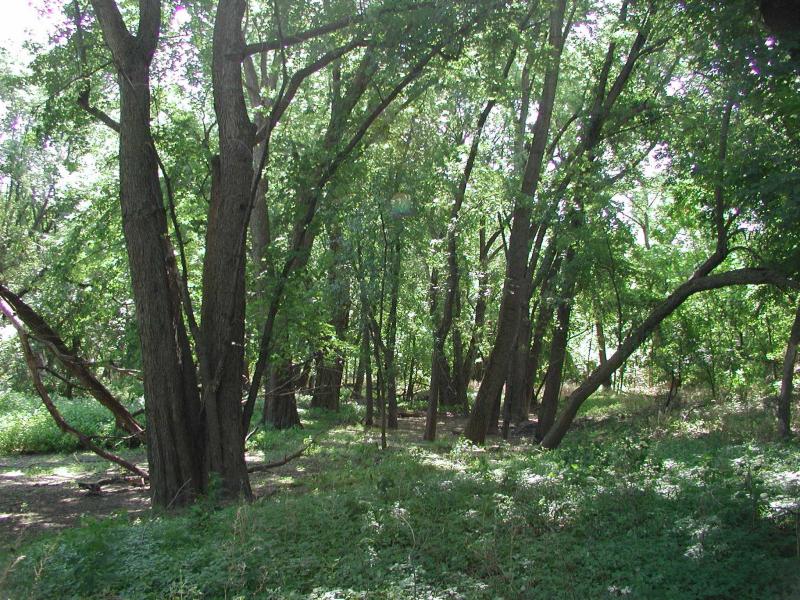
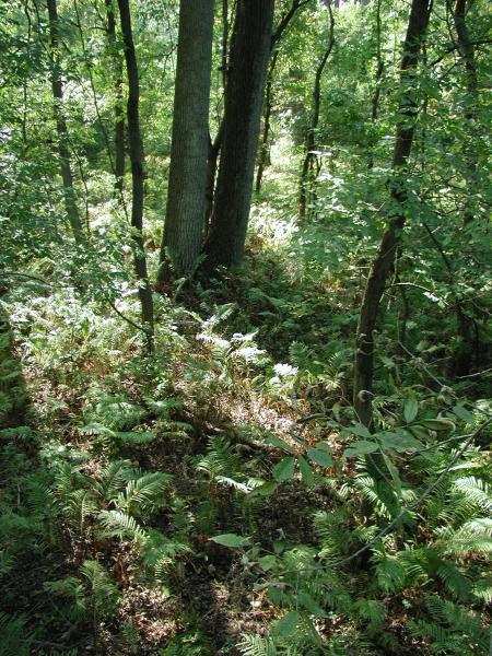
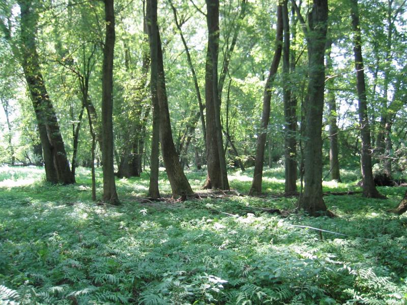
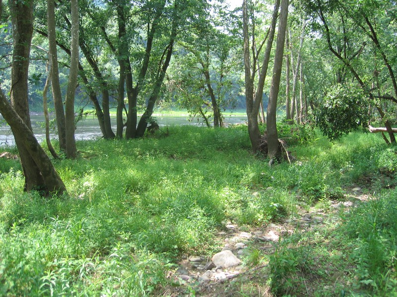
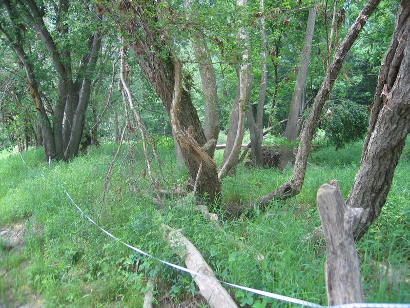
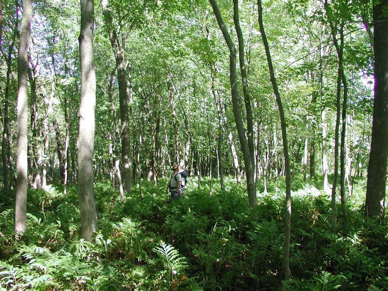
Floodplain Forest Images
Gregory J. Edinger
Gregory J. Edinger
Timothy G. Howard
Timothy G. Howard
Timothy G. Howard
Timothy G. Howard
Timothy G. Howard
Gregory J. Edinger
Gregory J. Edinger
Gregory J. Edinger
Gregory J. Edinger

Gregory J. Edinger
Timothy G. Howard
Gregory J. Edinger
Gregory J. Edinger
Classification
International Vegetation Classification Associations
This New York natural community encompasses all or part of the concept of the following International Vegetation Classification (IVC) natural community associations. These are often described at finer resolution than New York's natural communities. The IVC is developed and maintained by NatureServe.
- Red Maple - Black Cherry / Silky Dogwood Floodplain Forest (CEGL006503)
- Silver Maple / Sensitive Fern - Small-spike False Nettle Floodplain Forest (CEGL006176)
- Silver Maple - (Eastern Cottonwood) / Ostrich Fern - Canadian Woodnettle Floodplain Forest (CEGL006147)
- Sugar Maple - Ash species - American Basswood / Ostrich Fern - White Snakeroot Floodplain Forest (CEGL006114)
- River Birch - American Sycamore / Orange Jewelweed Floodplain Forest (CEGL006184)
- Pin Oak - Red Maple / Gray's Sedge - White Avens Wet Forest (CEGL006185)
NatureServe Ecological Systems
This New York natural community falls into the following ecological system(s). Ecological systems are often described at a coarser resolution than New York's natural communities and tend to represent clusters of associations found in similar environments. The ecological systems project is developed and maintained by NatureServe.
- Central Appalachian River Floodplain (CES202.608)
- Eastern Boreal Floodplain (CES103.588)
- Laurentian-Acadian Floodplain Forest (CES201.587)
Characteristic Species
-
Trees > 5m
- Acer negundo var. negundo (box-elder, ash-leaved maple)
- Acer rubrum var. rubrum (common red maple)
- Acer saccharinum (silver maple)
- Acer saccharum (sugar maple)
- Betula nigra (river birch)
- Carya cordiformis (bitternut hickory)
- Carya laciniosa (kingnut hickory, big shellbark hickory)
- Carya ovata var. ovata (shagbark hickory)
- Celtis occidentalis (northern hackberry)
- Fraxinus americana (white ash)
- Fraxinus pennsylvanica (green ash)
- Juglans cinerea (butternut)
- Juglans nigra (black walnut)
- Liriodendron tulipifera (tulip tree, tulip poplar, yellow poplar)
- Platanus occidentalis (eastern sycamore)
- Populus deltoides ssp. deltoides (eastern cottonwood)
- Quercus bicolor (swamp white oak)
- Quercus palustris (pin oak)
- Tilia americana var. americana (American basswood)
- Ulmus americana (American elm)
- Ulmus rubra (slippery elm)
-
Shrubs 2 - 5m
- Alnus incana ssp. rugosa (speckled alder)
- Carpinus caroliniana ssp. virginiana (musclewood, ironwood, American hornbeam)
- Cornus amomum ssp. amomum (silky dogwood)
- Viburnum lentago (nannyberry)
-
Shrubs < 2m
- Cornus amomum ssp. amomum (silky dogwood)
- Cornus racemosa (gray dogwood, red-panicled dogwood)
- Cornus sericea (red-osier dogwood)
- Lindera benzoin (spicebush)
- Staphylea trifolia (bladdernut)
- Viburnum dentatum var. lucidum (smooth arrowwood)
- Viburnum nudum var. cassinoides (northern wild-raisin)
-
Vines
- Clematis virginiana (virgin's-bower)
- Menispermum canadense (moonseed)
- Parthenocissus quinquefolia (Virginia-creeper)
- Toxicodendron radicans ssp. radicans (eastern poison-ivy)
- Vitis riparia (river grape, frost grape)
-
Herbs
- Ageratina altissima var. altissima (common white snakeroot)
- Arisaema triphyllum ssp. triphyllum (common jack-in-the-pulpit)
- Boehmeria cylindrica (false nettle)
- Carex crinita var. crinita (common fringed sedge)
- Carex intumescens (bladder sedge)
- Carex lacustris (lake-bank sedge)
- Carex lupulina (hop sedge)
- Carex stricta (tussock sedge)
- Carex tuckermanii (Tuckerman's sedge)
- Circaea canadensis (eastern enchanter's-nightshade)
- Geum canadense (white avens)
- Impatiens capensis (spotted jewelweed, spotted touch-me-not)
- Impatiens pallida (pale jewelweed, pale touch-me-not)
- Laportea canadensis (wood-nettle)
- Leersia oryzoides (rice cut grass)
- Leersia virginica (white cut grass)
- Lysimachia nummularia (moneywort, creeping-Jenny)
- Matteuccia struthiopteris var. pensylvanica (ostrich fern)
- Onoclea sensibilis (sensitive fern)
- Persicaria virginiana (jumpseed)
- Pilea pumila var. pumila (green-fruited clearweed)
- Saururus cernuus (lizard's-tail)
- Solidago canadensis var. canadensis (Canada goldenrod)
- Solidago gigantea (swamp goldenrod)
- Symplocarpus foetidus (skunk-cabbage)
- Urtica gracilis ssp. gracilis (American stinging nettle)
Similar Ecological Communities
- Red maple-hardwood swamp
(guide)
Red maple-hardwood swamps occur in broad depressions and are not necessarily adjacent to streams or rivers. The soils of red maple-hardwood swamps are very poorly drained and thus when located along rivers, they hold water for longer durations than is typical for floodplain forests.
- Silver maple-ash swamp
(guide)
Silver maple-ash swamps occur in broad depressions and are not necessarily adjacent to streams or rivers. The soils of silver maple-ash swamps are very poorly drained and thus when located along rivers, they hold water for longer durations than is typical for floodplain forests.
Vegetation
Percent cover
This figure helps visualize the structure and "look" or "feel" of a typical Floodplain Forest. Each bar represents the amount of "coverage" for all the species growing at that height. Because layers overlap (shrubs may grow under trees, for example), the shaded regions can add up to more than 100%.
Additional Resources
References
Barrett, N. and R. Enser. 1997. Alluvial plant communities within the Wood-Pawcatuck major basin, Rhode Island. Unpublished report. Rhode Island Natural Heritage Program, Providence, RI
Bechtel, D.A. and D.D. Sperduto. 1998. Floodplain forest natural communities along major rivers in New Hampshire. Unpublished report submitted to the Environmental Protection Agency prepared by New Hamphire Natural Heritage Program, Concord, New Hampshire.
Cowardin, L.M., V. Carter, F.C. Golet, and E.T. La Roe. 1979. Classification of wetlands and deepwater habitats of the United States. U.S. Fish and Wildlife Service. Washington, D.C. 131 pp.
Edinger, G. J., D. J. Evans, S. Gebauer, T. G. Howard, D. M. Hunt, and A. M. Olivero (editors). 2014. Ecological Communities of New York State. Second Edition. A revised and expanded edition of Carol Reschke’s Ecological Communities of New York State. New York Natural Heritage Program, New York State Department of Environmental Conservation, Albany, NY. https://www.nynhp.org/ecological-communities/
Edinger, Gregory J., D.J. Evans, Shane Gebauer, Timothy G. Howard, David M. Hunt, and Adele M. Olivero (editors). 2002. Ecological Communities of New York State. Second Edition. A revised and expanded edition of Carol Reschke's Ecological Communities of New York State. (Draft for review). New York Natural Heritage Program, New York State Department of Environmental Conservation. Albany, NY. 136 pp.
Fike, J. 1999. Terrestrial and Palustrine Plant Communities of Pennsylvania. Pennsylvania Natural Diversity Inventory, Harrisburg, PA.
Gordon, R.B. 1937. The primeval forest types of southwestern New York. New York State Museum Bull. No. 321, Albany, NY.
Kearsley, J.B. 1999. Inventory and vegetation classification of floodplain forest communities in Massachusetts. Rhodora 101:105-135.
Metzler, K.J. and A.W.H. Damman. 1985. Vegetation patterns in the Connecticut River floodplain in relation to frequency and duration of flooding. Nat. Can. 112:535-547.
New York Natural Heritage Program. 2024. New York Natural Heritage Program Databases. Albany, NY.
New York State Department of Environmental Conservation. 1995. Freshwater Wetlands: Delineation Manual. July 1995. New York State Department of Environmental Conservation. Division of Fish, Wildlife, and Marine Resources. Bureau of Habitat. Albany, NY.
Nichols, W.F., D.D. Sperduto, D.A. Bechtel, and K.F. Crowley. 2000. Floodplain forest natural communities along minor rivers and large streams in New Hampshire. New Hampshire Natural Heritage Inventory, Concord, New Hampshire.
Reschke, Carol. 1990. Ecological communities of New York State. New York Natural Heritage Program, New York State Department of Environmental Conservation. Latham, NY. 96 pp. plus xi.
Sorenson, E., M. Lapin, B. Engstrom, and R. Popp. 1998. Floodplain forests of Vermont: Some sites of ecological significance. Unpublished report submitted to the U.S. Environmental Protection Agency, Vermont Nongame and Natural Heritage Program, Waterbury, Vermont.
Veneman, P.L.M. and R.W. Tiner. 1990. Soil-vegetation correlations in the Connecticut River floodplain of western Massachusetts. Biological report 90(6). U.S. Fish and Wildlife Service, Washington, D.C.
Links
About This Guide
This guide was authored by: Gregory J. Edinger
Information for this guide was last updated on: January 18, 2024
Please cite this page as:
New York Natural Heritage Program. 2024.
Online Conservation Guide for
Floodplain forest.
Available from: https://guides.nynhp.org/floodplain-forest/.
Accessed July 26, 2024.