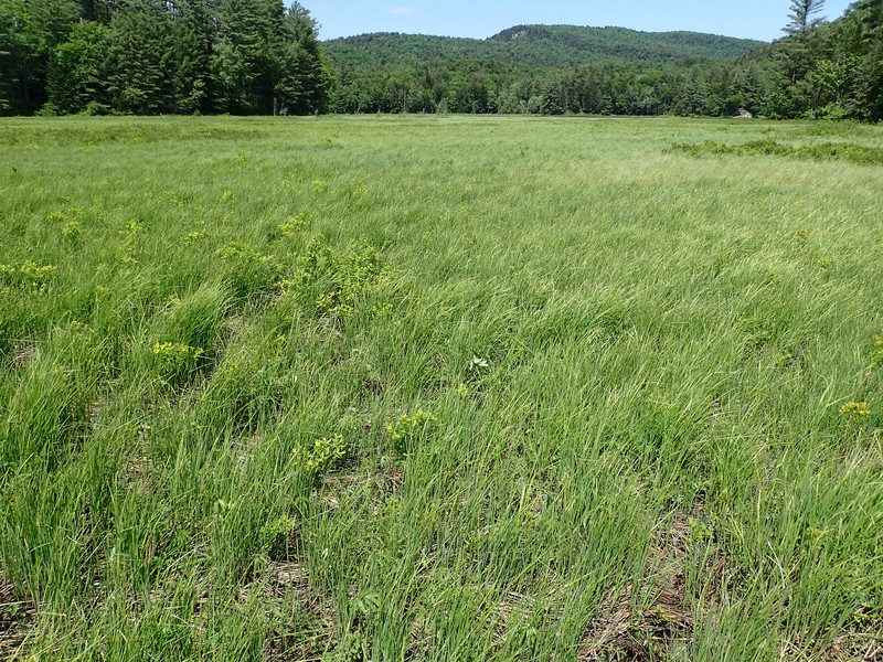
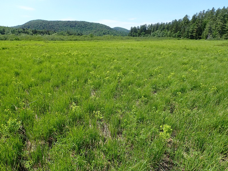
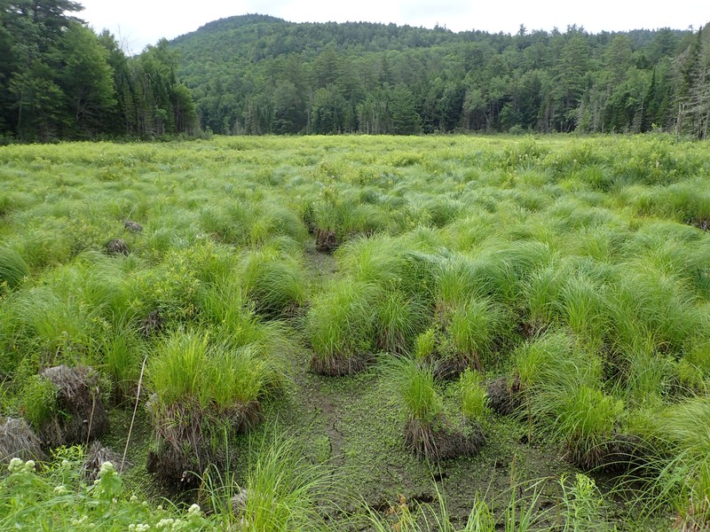
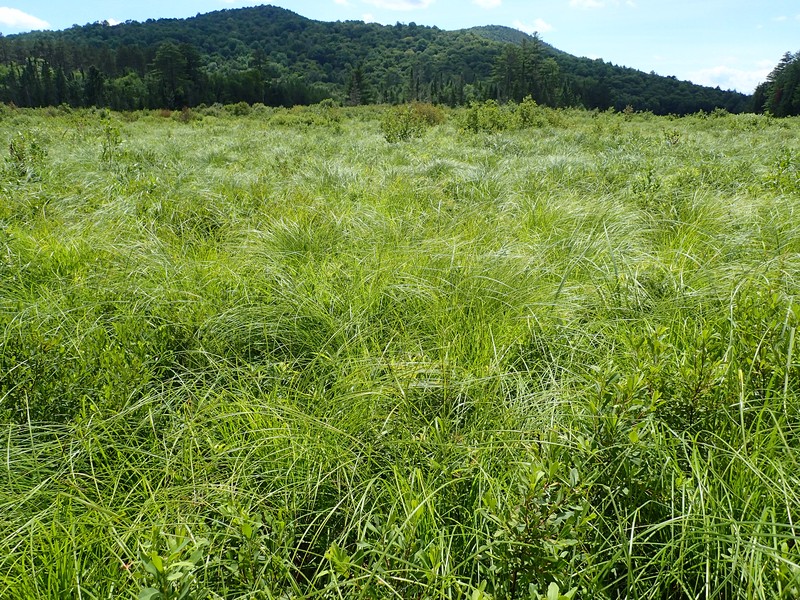
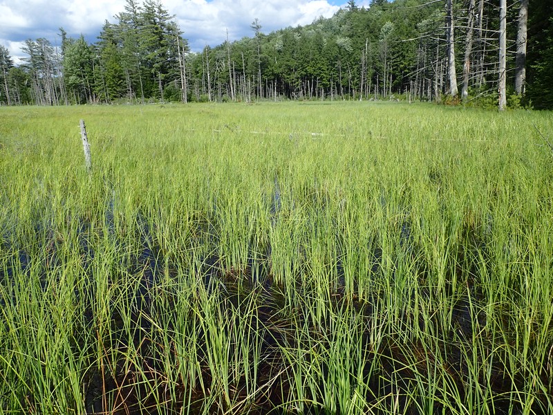
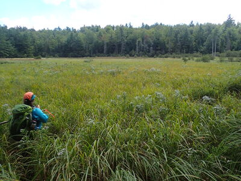
Sedge Meadow
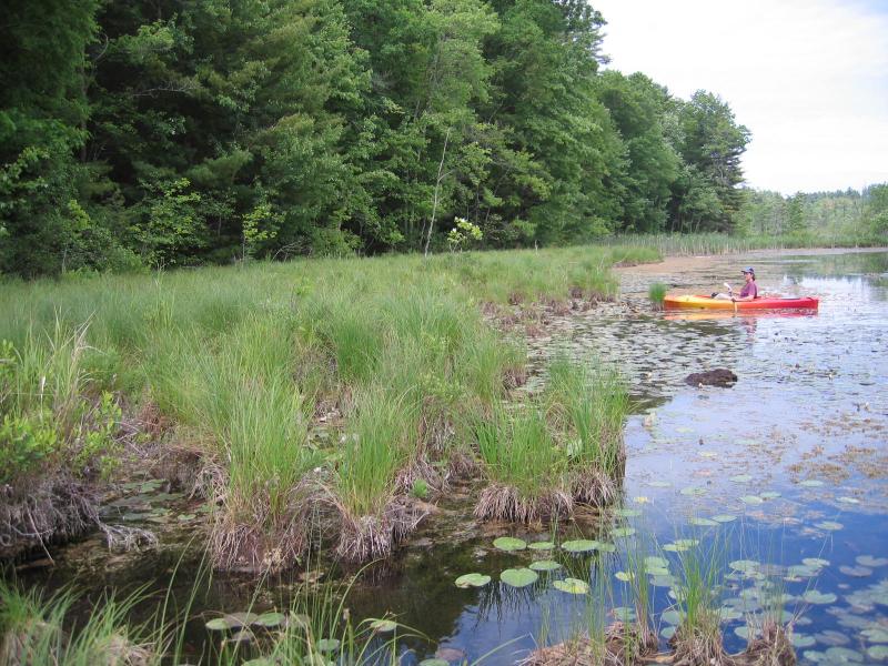
NY Natural Heritage director DJ Evans in kayak viewing tussock sedge (Carex stricta) dominated sedge meadow at Glen Lake Fen.
Gregory J. Edinger
- System
- Palustrine
- Subsystem
- Open Peatlands
- State Protection
- Not Listed
Not listed or protected by New York State.
- Federal Protection
- Not Listed
- State Conservation Status Rank
- S3
Vulnerable in New York - Vulnerable to disappearing from New York due to rarity or other factors (but not currently imperiled); typically 21 to 80 populations or locations in New York, few individuals, restricted range, few remaining acres (or miles of stream), and/or recent and widespread declines.
- Global Conservation Status Rank
- G5
Secure globally - Common in the world; widespread and abundant (but may be rare in some parts of its range).
Summary
Did you know?
The dominant plant of sedge meadows is tussock sedge (Carex stricta). Stands of this sedge provide excellent nesting habitat for rails and snipe. They, along with other sedges, form "hummocks" in sedge meadows. Hummocks are small mounds in the meadow composed of undecayed fibrous roots and rhizomes.
State Ranking Justification
There are several hundred occurrences statewide. A few documented occurrences have good viability and several are protected on public land or private conservation land. This community is sparsely scattered but widespread throughout the state. There are a few large, high quality examples. The current trend of this community is probably stable for occurences on public land and private conservation land, or declining slightly elsewhere due to moderate threats related to development pressure or alteration to the natural hydrology.
Short-term Trends
The number and acreage of sedge meadows in New York have probably remained stable in recent decades as a result of wetland protection regulations.
Long-term Trends
The number and acreage of sedge meadows in New York have probably declined substantially from historical numbers likely correlated to the alteration of natural hydrology (e.g., draining, impoundments) and agricultural activity, such as overgrazing or hay cutting.
Conservation and Management
Threats
Sedge meadows are threatened by adjacent development and its associated run-off (e.g., from agriculture, residential developments, mining, roads) and habitat alteration in the surrounding landscape (e.g., clearing, logging). In addition, alteration to the natural hydrological regime and the introduction of invasive species such as purple loosestrife (Lythrum salicaria), reedgrass (Phragmites australis ssp. australis ), Japanese knotweed (Reynoutria japonica), and reed canary grass (Phalaris arundinacea) also pose significant threats to this community.
Conservation Strategies and Management Practices
Consider how water flows around and into this wetland. Projects that occur near this community must consider the proximity of the development to this wetland and the potential for changing how water flows, both above ground and below ground, into this wetland. Terrestrial buffers provide nesting habitat for resident salamanders, frogs, and turtles, and additional food sources for locally nesting birds, and thus should be retained. Impervious surfaces that rapidly divert water to the wetland should be avoided.
Development and Mitigation Considerations
When considering road construction and other development activities, minimize actions that will change what water carries and how water travels to this community, both on the surface and underground. Water traveling over-the-ground as run-off usually carries an abundance of silt, clay, and other particulates during (and often after) a construction project. While still suspended in the water, these particulates make it difficult for aquatic animals to find food; after settling to the bottom of the wetland, these particulates bury small plants and animals and alter the natural functions of the community in many other ways. Thus, road construction and development activities near this community type should strive to minimize particulate-laden run-off into this community. Water traveling on the ground or seeping through the ground also carries dissolved minerals and chemicals. Road salt, for example, is becoming an increasing problem both to natural communities and as a contaminant in household wells. Fertilizers, detergents, and other chemicals that increase the nutrient levels in wetlands cause algae blooms and eventually an oxygen-depleted environment where few animals can live. Herbicides and pesticides often travel far from where they are applied and have lasting effects on the quality of the natural community. So, road construction and other development activities should strive to consider: 1. how water moves through the ground, 2. the types of dissolved substances these development activities may release, and 3. how to minimize the potential for these dissolved substances to reach this natural community.
Inventory Needs
Additional inventory efforts in regions with calcareous bedrock and wetlands along slow moving streams will likely turn up a few additional sites. Re-inventories of known sites will provide important information to help assess short and long-term changes.
Research Needs
Research better ways to accurately and efficiently measure and understand groundwater hydrology of sedge meadows. Further research into determining the proportion of the sedge meadow water inputs is needed (e.g., groundwater vs. surface). If a wetland is strongly groundwater influenced, traditional wetland buffers aimed at reducing surface water run-off may not sufficiently protect the groundwater hydrology.
Rare Species
- Ammodramus henslowii (Henslow's Sparrow) (guide)
- Asclepias purpurascens (Purple Milkweed) (guide)
- Cardamine rotundifolia (Round-leaved Water Cress) (guide)
- Carex bullata (Button Sedge) (guide)
- Carex buxbaumii (Brown Bog Sedge) (guide)
- Carex haydenii (Cloud Sedge) (guide)
- Carex lupuliformis (False Hop Sedge) (guide)
- Carex mitchelliana (Mitchell's Sedge) (guide)
- Carex sartwellii (Sartwell's Sedge) (guide)
- Carex schweinitzii (Schweinitz's Sedge) (guide)
- Castilleja coccinea (Indian Paintbrush) (guide)
- Cistothorus stellaris (Sedge Wren) (guide)
- Cuscuta polygonorum (Smartweed Dodder) (guide)
- Dichanthelium leibergii (Leiberg's Rosette Grass) (guide)
- Eleocharis tenuis var. pseudoptera (Sharp-angled Spike Rush) (guide)
- Fagitana littera (Marsh Fern Moth) (guide)
- Glyptemys muhlenbergii (Bog Turtle) (guide)
- Iris virginica (Southern Blue Flag) (guide)
- Lysimachia hybrida (Lowland Loosestrife) (guide)
- Paspalum laeve (Field Bead Grass) (guide)
- Phlox maculata ssp. maculata (Wild Sweet William) (guide)
- Polemonium vanbruntiae (Jacob's Ladder) (guide)
- Scirpus ancistrochaetus (Northeastern Bulrush) (guide)
- Scutellaria integrifolia (Hyssop Skullcap) (guide)
- Sylvilagus transitionalis (New England Cottontail) (guide)
- Symphyotrichum boreale (Northern Bog Aster) (guide)
- Tripsacum dactyloides (Northern Gama Grass) (guide)
- Viola primulifolia (Primrose-leaf Violet) (guide)
Range
New York State Distribution
This community is sparsely scattered but widespread throughout upstate New York. It is moderately common in the Northern Appalachians Ecoregion and relatively uncommon in the North Atlantic Coast Ecoregion.
Global Distribution
This broadly-defined community may be worldwide. Examples with the greatest biotic affinities to New York occurrences are suspected to span north to southern Canada, west to Minnesota, southwest to Indiana and Tennessee, southeast to Georgia, and northeast to Nova Scotia.
Best Places to See
- Claryville-Sundown Sholam Wild Forest, Catskill Park (Ulster County)
- Boreal Heritage Preserve, Adirondack Park (St. Lawrence County)
- Adirondack Park, Ferris Lake Wild Forest, Silver Lake Wildlife Management Area (Hamilton County)
Identification Comments
General Description
A wet meadow community that has organic soils (muck or fibrous peat) that are permanently saturated and seasonally flooded; there is usually limited peat accumulation in the substrate, but it is deep enough (usually at least 20 cm) to be treated as a peatland; otherwise it would be classified as a mineral soil wetland such as shallow emergent marsh. The peat of this community is usually fibrous, rather than sphagnous, and is usually underlain by deep muck. The dominant herbs are tussock-forming sedge species, such as tussock sedge (Carex stricta) (Edinger et al. 2002).
Characters Most Useful for Identification
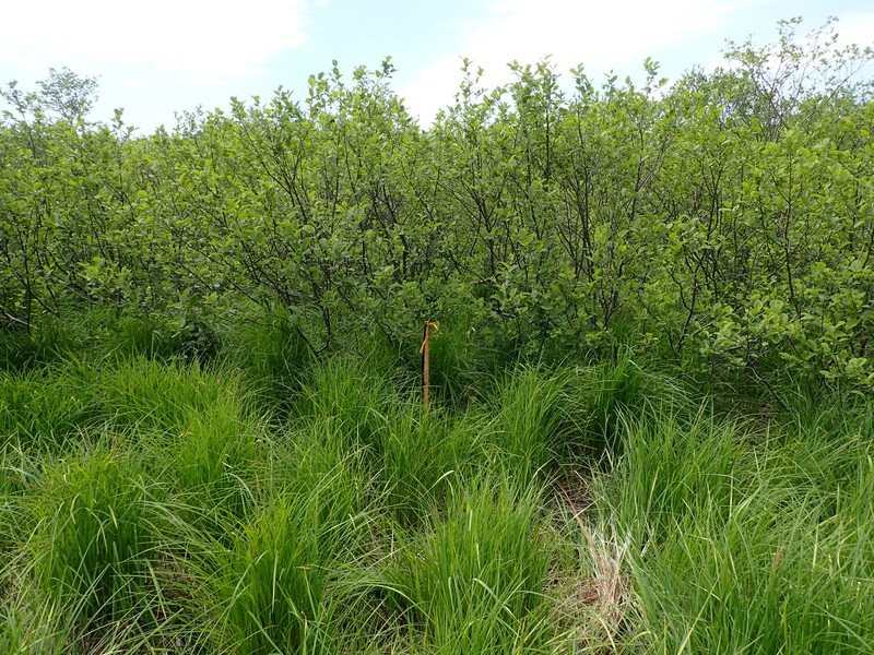
Sedge meadows are open wetlands dominated by fibrous peat (at least 20 cm deep) and tussock-forming sedges such as tussock sedge, which has at least 50% cover. The most common associate is bluejoint grass (Calamagrostis canadensis), which has less than 50% cover. Other associates include other sedges (Scirpus spp., Carex spp., Eleocharis spp., Dulichium arundinaceum), sensitive fern (Onoclea sensibilis), manna grasses (Glyceria spp.), and sparsely distributed shrubs (Alnus spp., Spiraea spp.).
Elevation Range
Known examples of this community have been found at elevations between 399 feet and 2,067 feet.
Best Time to See
Meadowsweet and hardhack (Spiraea spp.), when present, come into full bloom during midsummer. Many of the characteristic sedges and grasses are best identified during late summer, when they flower and fruit.
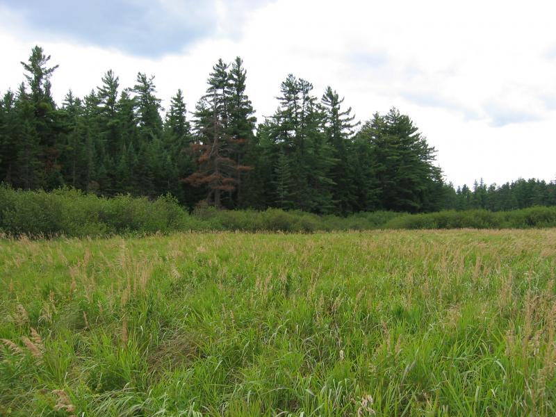
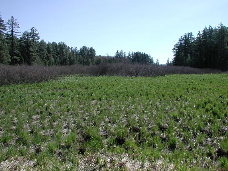
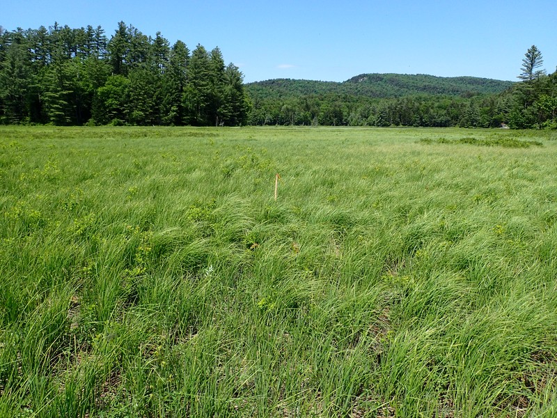
Sedge Meadow Images
Gregory J. Edinger
Shane Gebauer
Shane Gebauer
Gregory J. Edinger
Gregory J. Edinger
Gregory J. Edinger
Gregory J. Edinger
Gregory J. Edinger
Gregory J. Edinger
Gregory J. Edinger
Gregory J. Edinger
Classification
International Vegetation Classification Associations
This New York natural community encompasses all or part of the concept of the following International Vegetation Classification (IVC) natural community associations. These are often described at finer resolution than New York's natural communities. The IVC is developed and maintained by NatureServe.
- Upright Sedge - Blister Sedge Wet Meadow (CEGL006412)
NatureServe Ecological Systems
This New York natural community falls into the following ecological system(s). Ecological systems are often described at a coarser resolution than New York's natural communities and tend to represent clusters of associations found in similar environments. The ecological systems project is developed and maintained by NatureServe.
- Laurentian-Acadian Wet Meadow-Shrub Swamp (CES201.582)
Characteristic Species
-
Shrubs 2 - 5m
- Alnus incana ssp. rugosa (speckled alder)
-
Shrubs < 2m
- Spiraea alba var. latifolia (broad-leaved meadow-sweet)
- Spiraea tomentosa (steeplebush)
-
Herbs
- Calamagrostis canadensis var. canadensis (Canada bluejoint grass)
- Carex stricta (tussock sedge)
- Carex utriculata (bottle-shaped sedge)
- Carex vesicaria (lesser bladder sedge)
- Comarum palustre (marsh-cinquefoil)
- Equisetum fluviatile (river horsetail)
- Eutrochium maculatum var. maculatum (spotted Joe-Pye-weed)
- Glyceria canadensis (rattlesnake manna grass)
- Impatiens capensis (spotted jewelweed, spotted touch-me-not)
- Lysimachia terrestris (swamp-candles)
- Onoclea sensibilis (sensitive fern)
- Scirpus atrovirens (dark-green bulrush)
- Scirpus cyperinus (common wool-grass)
- Thelypteris palustris var. pubescens (marsh fern)
Similar Ecological Communities
- Inland poor fen
(guide)
Sedge meadows are open wetlands dominated by tussock sedge (Carex stricta) with bluejoint grass (Calamagrostis canadensis) as a common codominant. Tussock sedge may be present in inland poor fens, but it usually makes up less than 50% cover.
- Medium fen
(guide)
Medium fens are usually dominated, or co-dominated, by woolly-fruited sedge (Carex lasiocarpa ssp. americana) and sweet-gale (Myrica gale) in the bayberry family (Myricaceae) with lesser amounts of the heath shrubs. Sedge meadows are open wetlands dominated by fibrous peat (at least 20 cm deep) and tussock-forming sedges, such as tussock sedge (Carex stricta), which has at least 50% cover. The most common associate is bluejoint grass (Calamagrostis canadensis). Other associates include other sedges (Scirpus spp., Carex spp., Eleocharis spp., Dulichium arundinaceum), sensitive fern (Onoclea sensibilis), manna grasses (Glyceria spp.), and sparsely distributed shrubs (Alnus spp., Spiraea spp.).
- Rich graminoid fen
(guide)
Rich graminoid fens are strongly minerotrophic (pH 6.0 to 7.8), have deeper peat, and are usually more floristically diverse than sedge meadows. Rich graminoid fens may have tussock sedge (Carex stricta), but it usually makes up less than 50% of the herbaceous cover.
- Shallow emergent marsh
(guide)
Shallow emergent marshes have organic soils over mineral soils, and lack significant peat accumulation. Sedge meadows are dominated by tussock sedge (Carex stricta), whereas shallow emergent marshes have a variety of possible dominant species.
Vegetation
Percent cover
This figure helps visualize the structure and "look" or "feel" of a typical Sedge Meadow. Each bar represents the amount of "coverage" for all the species growing at that height. Because layers overlap (shrubs may grow under trees, for example), the shaded regions can add up to more than 100%.
Additional Resources
References
Cowardin, L.M., V. Carter, F.C. Golet, and E.T. La Roe. 1979. Classification of wetlands and deepwater habitats of the United States. U.S. Fish and Wildlife Service. Washington, D.C. 131 pp.
Damman, A.W.H. and T.W. French. 1987. The ecology of peat bogs of the glaciated northeastern United States: a community profile. U.S. Fish and Wildlife Service Biological Report 85(7.16). 100 pp.
Edinger, G. J., D. J. Evans, S. Gebauer, T. G. Howard, D. M. Hunt, and A. M. Olivero (editors). 2014. Ecological Communities of New York State. Second Edition. A revised and expanded edition of Carol Reschke’s Ecological Communities of New York State. New York Natural Heritage Program, New York State Department of Environmental Conservation, Albany, NY. https://www.nynhp.org/ecological-communities/
Edinger, Gregory J., D.J. Evans, Shane Gebauer, Timothy G. Howard, David M. Hunt, and Adele M. Olivero (editors). 2002. Ecological Communities of New York State. Second Edition. A revised and expanded edition of Carol Reschke's Ecological Communities of New York State. (Draft for review). New York Natural Heritage Program, New York State Department of Environmental Conservation. Albany, NY. 136 pp.
Gawler, S. C. 2001. Natural landscapes of Maine: Natural community profiles. Open (non-forested) types. Final review draft, July 2001. Maine Natural Areas Program. Department of Conservation. Augusta, ME.
Langdon, Stephen F., M. Dovciak, and D.J. Leopold. 2020. Tree Encroachment Varies by Plant Community in a Large Boreal Peatland Complex in the Boreal-Temperate Ecotone of Northeastern USA. Wetlands. https://doi.org/10.1007/s13157-020-01319-z
New York Natural Heritage Program. 2024. New York Natural Heritage Program Databases. Albany, NY.
New York State Department of Environmental Conservation. 1995. Freshwater Wetlands: Delineation Manual. July 1995. New York State Department of Environmental Conservation. Division of Fish, Wildlife, and Marine Resources. Bureau of Habitat. Albany, NY.
Reschke, Carol. 1990. Ecological communities of New York State. New York Natural Heritage Program, New York State Department of Environmental Conservation. Latham, NY. 96 pp. plus xi.
Sperduto, D.D. and W.F. Nichols. 2004. Natural Communities of New Hampshire. New Hampshire Natural Heritage Bureau, Concord, New Hampshire. Pub. University of New Hampshire Cooperative Extension, Durham, New Hampshire.
Swain, P.C. and J.B. Kearsley. 2000. Classification of the Natural Communities of Massachusetts. Unpublished draft July 2000. Natural Heritage and Endangered Species Program, Massachusetts Division of Fisheries and Wildlife, Westborough. MA.
Links
About This Guide
This guide was authored by: Gregory J. Edinger
Information for this guide was last updated on: November 15, 2023
Please cite this page as:
New York Natural Heritage Program. 2024.
Online Conservation Guide for
Sedge meadow.
Available from: https://guides.nynhp.org/sedge-meadow/.
Accessed July 26, 2024.