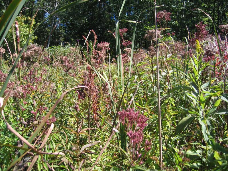
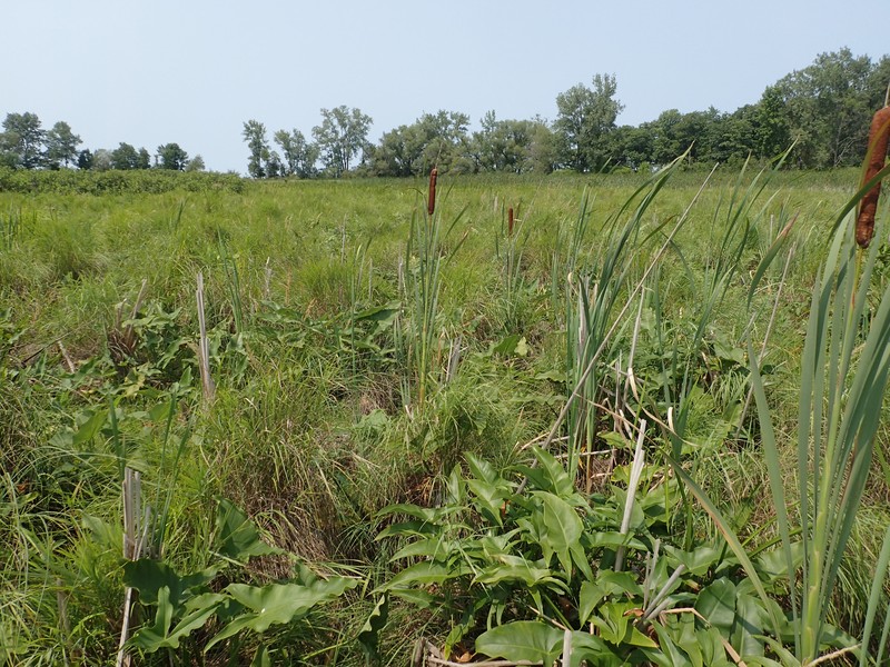
Shallow Emergent Marsh
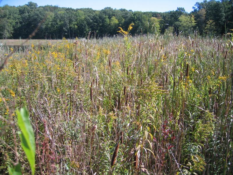
Shallow emergent marsh along the south shore of Newton Ponds.
Gregory J. Edinger
- System
- Palustrine
- Subsystem
- Open Mineral Soil Wetlands
- State Protection
- Not Listed
Not listed or protected by New York State.
- Federal Protection
- Not Listed
- State Conservation Status Rank
- S3
Vulnerable in New York - Vulnerable to disappearing from New York due to rarity or other factors (but not currently imperiled); typically 21 to 80 populations or locations in New York, few individuals, restricted range, few remaining acres (or miles of stream), and/or recent and widespread declines.
- Global Conservation Status Rank
- G5
Secure globally - Common in the world; widespread and abundant (but may be rare in some parts of its range).
Summary
Did you know?
One characteristic plant of shallow emergent marshes is the cardinal flower. The bright, scarlet red flower attracts its pollinator, the ruby-throated hummingbird. This hummingbird is the only hummingbird that breeds in eastern North America. It winters in Central America and the cardinal flower has timed its blooming season to correspond to the hummingbird's migration south. According to legend, the flower was named for the red robes worn by cardinals in the Catholic Church.
State Ranking Justification
There are several thousand occurrences statewide. Some documented occurrences have good viability and several are protected on public land or private conservation land. This community has statewide distribution, and includes a few large, high quality examples. The current trend of this community is probably stable for occurrences on public land, or declining slightly elsewhere due to moderate threats that include alteration of the natural hydrology and invasive species.
Short-term Trends
Emergent covertype acreage and relative abundance appeared to decline slightly statewide (Huffman & Associates, Inc. 2000). There may be a few cases where this community has increased as a result of abandoned agriculture land.
Long-term Trends
The number and acreage of shallow emergent marshes in New York have substantially declined (50-75%) from historical numbers likely correlated to the alteration to the natural hydrology and to direct destruction, especially near urban areas and historical conversion for agricultural purposes.
Conservation and Management
Threats
Shallow emergent marshes are threatened by development and its associated run-off (e.g., agriculture, residential, roads/bridges, mining operations), habitat alteration (e.g., pollution, nutrient loading, mowing, utility ROWs), and recreational overuse (e.g., motor boating, canoeing, fishing, trampling). Alteration to the natural hydrological regime is also a threat to this community (e.g., impoundments, dredging, blocked culverts, beaver). Several shallow emergent marshes are threatened by invasive species, such as purple loosestrife (Lythrum salicaria), reedgrass (Phragmites australis), and frog-bit (Hydrocharis morsus-ranae).
Conservation Strategies and Management Practices
Where practical, establish and maintain a natural wetland buffer to reduce storm-water, pollution, and nutrient run-off, while simultaneously capturing sediments before they reach the wetland. Buffer width should take into account the erodibility of the surrounding soils, slope steepness, and current land use. Wetlands protected under Article 24 are known as New York State "regulated" wetlands. The regulated area includes the wetlands themselves, as well as a protective buffer or "adjacent area" extending 100 feet landward of the wetland boundary (NYS DEC 1995). If possible, minimize the number and size of impervious surfaces in the surrounding landscape. Avoid habitat alteration within the wetland and surrounding landscape. For example, roads and trails should be routed around wetlands, and ideally not pass through the buffer area. If the wetland must be crossed, then bridges and boardwalks are preferred over filling. Restore past impacts, such as removing obsolete impoundments and ditches in order to restore the natural hydrology. Prevent the spread of invasive exotic species into the wetland through appropriate direct management, and by minimizing potential dispersal corridors, such as roads.
Development and Mitigation Considerations
When considering road construction and other development activities, minimize actions that will change what water carries and how water travels to this community, both on the surface and underground. Water traveling over-the-ground as runoff usually carries an abundance of silt, clay, and other particulates during (and often after) a construction project. While still suspended in the water, these particulates make it difficult for aquatic animals to find food; after settling to the bottom of the system, they bury small plants and animals and alter the natural functions of the community in many other ways. Thus, road construction and development activities near this community type should strive to minimize particulate-laden run-off into this community. Water traveling on the ground or seeping through the ground also carries dissolved minerals and chemicals. Road salt, for example, is becoming an increasing problem both to natural communities and as a contaminant in household wells. Fertilizers, detergents, and other chemicals that increase the nutrient levels in wetlands cause algal blooms and eventually an oxygen-depleted environment in which few animals can live. Herbicides and pesticides often travel far from where they are applied and have lasting effects on the quality of the natural community. So, road construction and other development activities should strive to consider: 1. how water moves through the ground, 2. the types of dissolved substances these development activities may release, and 3. how to minimize the potential for these dissolved substances to reach this natural community.
Inventory Needs
Survey for occurrences statewide to advance documentation and classification of shallow emergent marshes. A statewide review of shallow emergent marshes is desirable. Continue searching for large sites in good condition (A- to AB-ranked).
Research Needs
Research composition of shallow emergent marshes statewide in order to characterize variations. Collect sufficient plot data to support the recognition of several distinct shallow emergent marsh types based on composition and by ecoregion (e.g., Typha spp. dominant, Phalaris arundinacea dominant, Scirpus cyperinus dominant, Carex spp. dominant, etc.).
Rare Species
- Amphipoea erepta ryensis (An Ear Moth) (guide)
- Arigomphus cornutus (Horned Clubtail) (guide)
- Bidens laevis (Smooth Beggar Ticks) (guide)
- Cardamine rotundifolia (Round-leaved Water Cress) (guide)
- Carex arcta (Northern Clustered Sedge) (guide)
- Carex atherodes (Wheat Sedge) (guide)
- Carex conjuncta (Soft Fox Sedge) (guide)
- Carex davisii (Davis' Sedge) (guide)
- Carex frankii (Frank's Sedge) (guide)
- Carex haydenii (Cloud Sedge) (guide)
- Carex lupuliformis (False Hop Sedge) (guide)
- Carex mitchelliana (Mitchell's Sedge) (guide)
- Carex nigra (Black Sedge) (guide)
- Carex schweinitzii (Schweinitz's Sedge) (guide)
- Carex shortiana (Short's Sedge) (guide)
- Carex straminea (Straw Sedge) (guide)
- Carex styloflexa (Bent Sedge) (guide)
- Carex typhina (Cat-tail Sedge) (guide)
- Chlidonias niger (Black Tern) (guide)
- Circus hudsonius (Northern Harrier) (guide)
- Cistothorus stellaris (Sedge Wren) (guide)
- Crotalus horridus (Timber Rattlesnake) (guide)
- Cuscuta polygonorum (Smartweed Dodder) (guide)
- Emydoidea blandingii (Blanding's Turtle) (guide)
- Fagitana littera (Marsh Fern Moth) (guide)
- Geum virginianum (Cream-colored Avens) (guide)
- Hottonia inflata (American Featherfoil) (guide)
- Hypericum adpressum (Creeping St. John's Wort) (guide)
- Iris virginica (Southern Blue Flag) (guide)
- Ixobrychus exilis (Least Bittern) (guide)
- Juncus brachycarpus (Short-fruited Rush) (guide)
- Juncus debilis (Weak Rush) (guide)
- Juncus subcaudatus (Spreading Rush) (guide)
- Lestes unguiculatus (Lyre-tipped Spreadwing) (guide)
- Lithobates kauffeldi (Atlantic Coast Leopard Frog) (guide)
- Lycopus rubellus (Stalked Bugleweed) (guide)
- Lysimachia hybrida (Lowland Loosestrife) (guide)
- Macropis nuda (Common Loosestrife Oil Bee) (guide)
- Myotis lucifugus (Little Brown Bat) (guide)
- Myriophyllum pinnatum (Cut-leaved Water Milfoil) (guide)
- Persicaria setacea (Bristly Smartweed) (guide)
- Podilymbus podiceps (Pied-billed Grebe) (guide)
- Polemonium vanbruntiae (Jacob's Ladder) (guide)
- Populus heterophylla (Swamp Cottonwood) (guide)
- Rallus elegans (King Rail) (guide)
- Ranunculus septentrionalis (Southern Swamp Buttercup) (guide)
- Schoenoplectus heterochaetus (Slender Bulrush) (guide)
- Scirpus ancistrochaetus (Northeastern Bulrush) (guide)
- Scirpus georgianus (Georgia Bulrush) (guide)
- Sterna hirundo (Common Tern) (guide)
- Sylvilagus transitionalis (New England Cottontail) (guide)
Range
New York State Distribution
This community is widespread throughout the state, including the North Atlantic Coast Ecoregion. It is probably represented by different regional variants. Emergent wetlands are relatively uncommon, accounting for only 10 percent, or about 239,000 acres, of the freshwater wetlands statewide in the mid-1990s. Emergent wetland as a covertype is most common in the Appalachian Highlands and Hudson Valley, where it accounts for about 11.5 percent of all wetlands. Emergent wetlands are the least common covertype in the Lake Plains and Coastal Lowlands, where only 8 percent of all wetlands are emergent (Huffman & Associates, Inc. 2000).
Global Distribution
This physically and physiognomically broadly-defined community is likely to be widespread worldwide. Examples with the greatest biotic affinities to New York occurrences are suspected to span north to southern Canada, west to Minnesota, southwest to Indiana and Tennessee, southeast to Georgia, and northeast to Nova Scotia.
Best Places to See
- Adirondack Park (Washington County)
- Fair Haven Beach State Park
- Lake Shore Marshes Wildlife Management Area (Wayne County)
- Selkirk Shores State Park (Oswego County)
- Jacquins Pond Wildlife Management Area
- Capital District Wildlife Management Area (Rensselaer County)
- Lakeview Marsh Wildlife Management Area (Jefferson County)
- Upper And Lower Lakes Wildlife Management Area (St. Lawrence County)
Identification Comments
General Description
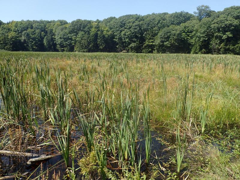
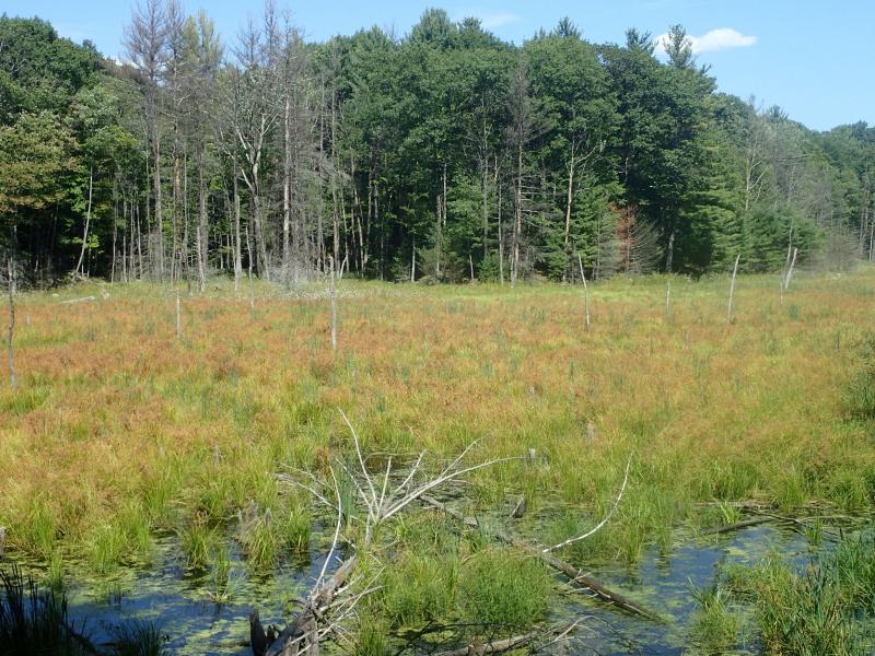
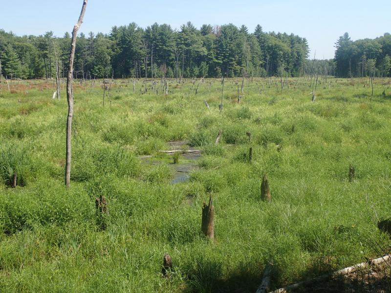
A marsh meadow community that occurs on mineral soil or muck soils that are permanently saturated and seasonally flooded. This marsh is better drained than a deep emergent marsh; water depths may range from 6 inches to 3.3 feet (15 cm to 1 m) during flood stages, but the water level usually drops by mid to late summer and the substrate is exposed. Shallow emergent marshes typically occur in lake basins and along streams. Deep and shallow emergent marshes often intergrade, and they may occur together in a complex mosaic in a large wetland (Edinger et al. 2002).
Characters Most Useful for Identification
Shallow emergent marshes have a very diverse assemblage of herbaceous plants that include grasses, sedges, cattails, wetland ferns, and a variety of forbs. These marshes often have a number of different types of sedges, bulrushes, and rushes, but have less than 50% cover of the tussocks-forming sedges (Carex stricta, Carex aquatilis).
Elevation Range
Known examples of this community have been found at elevations between 98 feet and 1,930 feet.
Best Time to See
The best time to view the diversity of plants in a shallow emergent marsh is in the summer, from June to early August.
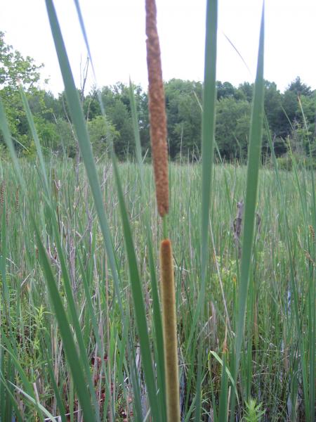
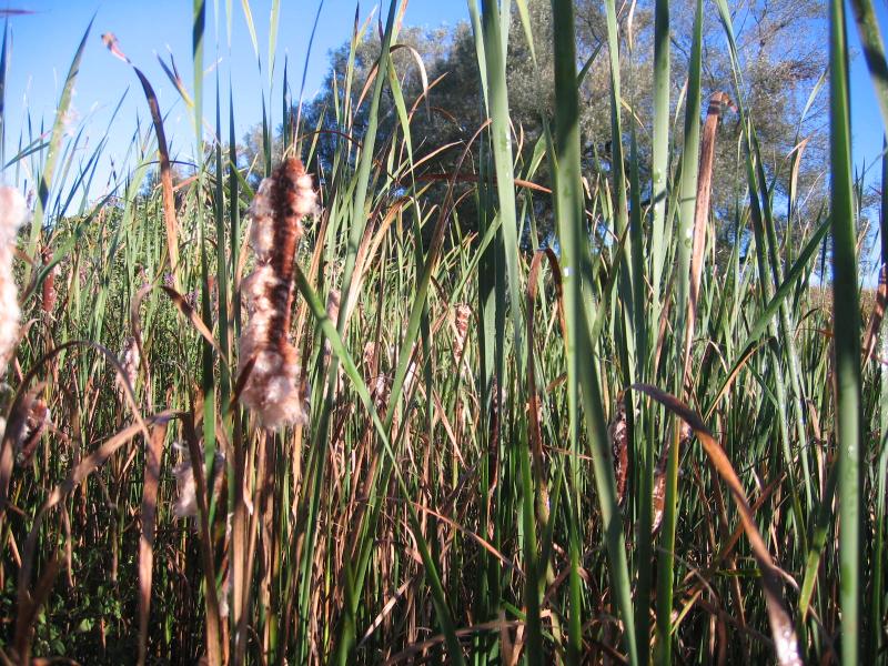
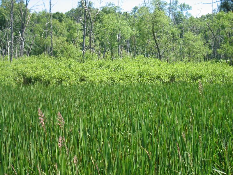
Shallow Emergent Marsh Images
Gregory J. Edinger
Gregory J. Edinger
Gregory J. Edinger
Gregory J. Edinger
Gregory J. Edinger
Gregory J. Edinger
Gregory J. Edinger
Gregory J. Edinger
Gregory J. Edinger
Classification
International Vegetation Classification Associations
This New York natural community encompasses all or part of the concept of the following International Vegetation Classification (IVC) natural community associations. These are often described at finer resolution than New York's natural communities. The IVC is developed and maintained by NatureServe.
- Nodding Beggarticks - Swamp Verbena - Smartweed species Marsh (CEGL006446)
- Bluejoint - Sedge species Laurentian-Acadian Wet Meadow (CEGL005448)
- Bluejoint - Bulrush species - Threeway Sedge Wet Meadow (CEGL006519)
- Lake Sedge Midwest Wet Meadow (CEGL002256)
- Hairy-fruit Sedge Rivershore Wet Meadow (CEGL006447)
- Rice Cutgrass - Fowl Mannagrass - (Bulrush species, Orange Jewelweed) Wet Meadow (CEGL005106)
- Rice Cutgrass - Broadleaf Arrowhead Wet Meadow (CEGL006461)
- Reed Canarygrass Eastern Ruderal Marsh (CEGL006044)
- Japanese Knotweed Ruderal Wet Meadow (CEGL008472)
- Woolgrass Wet Meadow (CEGL006349)
- Steeplebush - Blackberry species / Reed Canarygrass Ruderal Wet Shrubland (CEGL006571)
NatureServe Ecological Systems
This New York natural community falls into the following ecological system(s). Ecological systems are often described at a coarser resolution than New York's natural communities and tend to represent clusters of associations found in similar environments. The ecological systems project is developed and maintained by NatureServe.
- Central Appalachian Stream and Riparian (CES202.609)
- High Allegheny Wetland (CES202.069)
- Laurentian-Acadian Freshwater Marsh (CES201.594)
- Laurentian-Acadian Wet Meadow-Shrub Swamp (CES201.582)
- North-Central Interior Wet Meadow-Shrub Swamp (CES202.701)
Characteristic Species
-
Trees > 5m
- Acer rubrum var. rubrum (common red maple)
-
Shrubs < 2m
- Spiraea tomentosa (steeplebush)
-
Herbs
- Boehmeria cylindrica (false nettle)
- Calamagrostis canadensis var. canadensis (Canada bluejoint grass)
- Carex lacustris (lake-bank sedge)
- Carex stricta (tussock sedge)
- Glyceria canadensis (rattlesnake manna grass)
- Impatiens capensis (spotted jewelweed, spotted touch-me-not)
- Juncus effusus ssp. solutus (common soft rush)
- Leersia oryzoides (rice cut grass)
- Onoclea sensibilis (sensitive fern)
- Persicaria sagittata (arrow-leaved tear-thumb)
- Phalaris arundinacea (reed canary grass)
- Poa trivialis ssp. trivialis (rough-sheathed blue grass)
- Scirpus atrovirens (dark-green bulrush)
- Scirpus cyperinus (common wool-grass)
- Solidago gigantea (swamp goldenrod)
- Thelypteris palustris var. pubescens (marsh fern)
- Typha latifolia (wide-leaved cat-tail)
-
Floating-leaved aquatics
- Hydrocharis morsus-ranae (European frog's-bit)
Similar Ecological Communities
- Deep emergent marsh
(guide)
Deep emergent marshes are also on mineral soils but are usually flooded for most of the year. The most abundant plants in a deep emergent marsh are cattails (Typha spp.), bulrushes (Scirpus spp.), bur-weeds (Sparganium spp.), and other emergent aquatic plants. Shallow emergent marshes are found on permanently saturated soils that are seasonally flooded, but the water levels usually drop by mid to late summer to expose the substrate.
- Sedge meadow
(guide)
Sedge meadows typically have peat accumulation in the substrate and this peat is usually underlain by deep muck. The dominant plants in sedge meadows are members of the sedge family (Cyperaceae), typically the genus Carex. There is no peat accumulation in a shallow emergent marsh. Shallow emergent marshes are found on deep mineral soil or sometimes deep muck soils. Sedges may be abundant in shallow emrgent marshes but are not dominant.
Vegetation
Percent cover
This figure helps visualize the structure and "look" or "feel" of a typical Shallow Emergent Marsh. Each bar represents the amount of "coverage" for all the species growing at that height. Because layers overlap (shrubs may grow under trees, for example), the shaded regions can add up to more than 100%.
Additional Resources
References
Bray, W.L. 1915. The development of the vegetation of New York State. New York State College of Forestry, Tech. Publ. No. 3, Syracuse, NY.
Cowardin, L.M., V. Carter, F.C. Golet, and E.T. La Roe. 1979. Classification of wetlands and deepwater habitats of the United States. U.S. Fish and Wildlife Service. Washington, D.C. 131 pp.
Edinger, G. J., D. J. Evans, S. Gebauer, T. G. Howard, D. M. Hunt, and A. M. Olivero (editors). 2014. Ecological Communities of New York State. Second Edition. A revised and expanded edition of Carol Reschke’s Ecological Communities of New York State. New York Natural Heritage Program, New York State Department of Environmental Conservation, Albany, NY. https://www.nynhp.org/ecological-communities/
Edinger, Gregory J., D.J. Evans, Shane Gebauer, Timothy G. Howard, David M. Hunt, and Adele M. Olivero (editors). 2002. Ecological Communities of New York State. Second Edition. A revised and expanded edition of Carol Reschke's Ecological Communities of New York State. (Draft for review). New York Natural Heritage Program, New York State Department of Environmental Conservation. Albany, NY. 136 pp.
Gilman, B. A. 1976. Wetland plant communities along the eastern shoreline of Lake Ontario. M.S. thesis, State University of New York College of Environmental Science and Forestry, Syracuse, New York.
Hotchkiss, Neil. 1932. A botanical survey of the Tug Hill plateau. New York State Museum Bulletin No. 287. Albany, NY.
Huffman & Associates, Inc. (August 1999) Finalized June 2000. Wetlands Status and Trend Analysis of New York State - Mid-1980's to Mid-1990's. Prepared for New York State Department of Environmental Conservation. June 2000. Larkspur, California. l7pp. plus attachments.
Levine, E. 1998. Bull's birds of New York State. Comstock Publishing Associates, Ithaca, NY.
Metzler, K.J. and A.W.H. Damman. 1985. Vegetation patterns in the Connecticut River floodplain in relation to frequency and duration of flooding. Nat. Can. 112:535-547.
New York Natural Heritage Program. 2024. New York Natural Heritage Program Databases. Albany, NY.
New York State Department of Environmental Conservation. 1995. Freshwater Wetlands: Delineation Manual. July 1995. New York State Department of Environmental Conservation. Division of Fish, Wildlife, and Marine Resources. Bureau of Habitat. Albany, NY.
Reschke, Carol. 1990. Ecological communities of New York State. New York Natural Heritage Program, New York State Department of Environmental Conservation. Latham, NY. 96 pp. plus xi.
Tiner, R. W., Jr. 1985a. Wetlands of Delaware. Cooperative publication of USDI Fish & Wildlife Service, National Wetlands Inventory, Newton Corner, MA, and Delaware Department of Natural Resources and Environmental Control, Dover, DE. 77 pp.
Tiner, R. W., Jr. 1985b. Wetlands of New Jersey. USDI Fish & Wildlife Service, National Wetlands Inventory, Newton Corner, MA. 117 pp.
Links
About This Guide
This guide was authored by: Aissa Feldmann
Information for this guide was last updated on: November 13, 2023
Please cite this page as:
New York Natural Heritage Program. 2024.
Online Conservation Guide for
Shallow emergent marsh.
Available from: https://guides.nynhp.org/shallow-emergent-marsh/.
Accessed July 26, 2024.